View
Add
Copy
Edit
Delete
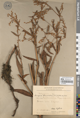
LE 01083989
Groups of specimens: Образцы сектора Сибири и Дальнего Востока РоссииRecord creation: 2023-02-27, Marina Yarichina, PhotoScan D2.Citation: Specimen LE 01083989 // Virtual herbarium of Komarov Botanical Institute RAS — http://re.herbariumle.ru/01083989
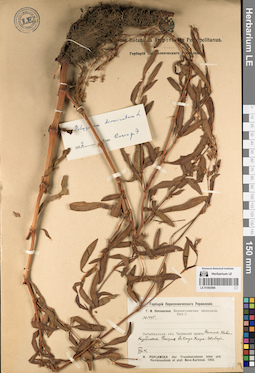
LE 01083988
Groups of specimens: Образцы сектора Сибири и Дальнего Востока РоссииRecord creation: 2023-02-27, Marina Yarichina, PhotoScan D2.Citation: Specimen LE 01083988 // Virtual herbarium of Komarov Botanical Institute RAS — http://re.herbariumle.ru/01083988
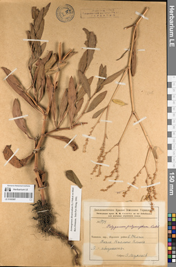
LE 01083987
Groups of specimens: Образцы сектора Сибири и Дальнего Востока РоссииRecord creation: 2023-02-27, Marina Yarichina, PhotoScan D2.Citation: Specimen LE 01083987 // Virtual herbarium of Komarov Botanical Institute RAS — http://re.herbariumle.ru/01083987
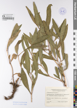
LE 01083819
Groups of specimens: Образцы сектора Сибири и Дальнего Востока РоссииRecord creation: 2023-02-27, Marina Yarichina, PhotoScan D2.Citation: Specimen LE 01083819 // Virtual herbarium of Komarov Botanical Institute RAS — http://re.herbariumle.ru/01083819
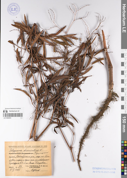
LE 01083818
Groups of specimens: Образцы сектора Сибири и Дальнего Востока РоссииRecord creation: 2023-02-27, Marina Yarichina, PhotoScan D2.Citation: Specimen LE 01083818 // Virtual herbarium of Komarov Botanical Institute RAS — http://re.herbariumle.ru/01083818
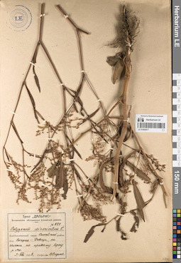
LE 01083817
Groups of specimens: Образцы сектора Сибири и Дальнего Востока РоссииRecord creation: 2023-02-27, Marina Yarichina, PhotoScan D2.Citation: Specimen LE 01083817 // Virtual herbarium of Komarov Botanical Institute RAS — http://re.herbariumle.ru/01083817
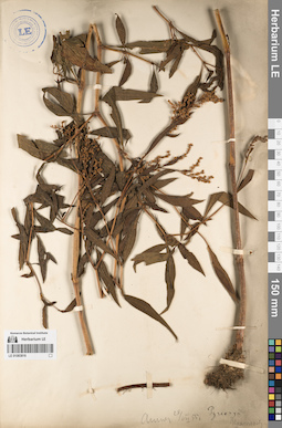
LE 01083816
Groups of specimens: Образцы сектора Сибири и Дальнего Востока РоссииRecord creation: 2023-02-27, Marina Yarichina, PhotoScan D2.Citation: Specimen LE 01083816 // Virtual herbarium of Komarov Botanical Institute RAS — http://re.herbariumle.ru/01083816
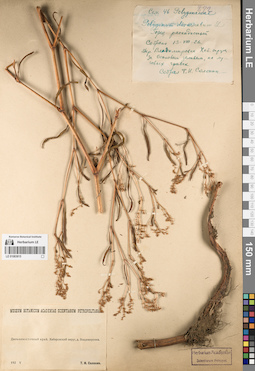
LE 01083815
Groups of specimens: Образцы сектора Сибири и Дальнего Востока РоссииRecord creation: 2023-02-27, Marina Yarichina, PhotoScan D2.Citation: Specimen LE 01083815 // Virtual herbarium of Komarov Botanical Institute RAS — http://re.herbariumle.ru/01083815
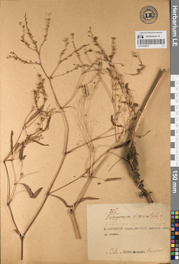
LE 01083814
Groups of specimens: Образцы сектора Сибири и Дальнего Востока РоссииRecord creation: 2023-02-27, Marina Yarichina, PhotoScan D2.Citation: Specimen LE 01083814 // Virtual herbarium of Komarov Botanical Institute RAS — http://re.herbariumle.ru/01083814
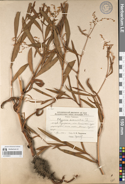
LE 01083813
Groups of specimens: Образцы сектора Сибири и Дальнего Востока РоссииRecord creation: 2023-02-27, Marina Yarichina, PhotoScan D2.Citation: Specimen LE 01083813 // Virtual herbarium of Komarov Botanical Institute RAS — http://re.herbariumle.ru/01083813
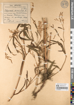
LE 01083812
Groups of specimens: Образцы сектора Сибири и Дальнего Востока РоссииRecord creation: 2023-02-27, Marina Yarichina, PhotoScan D2.Citation: Specimen LE 01083812 // Virtual herbarium of Komarov Botanical Institute RAS — http://re.herbariumle.ru/01083812
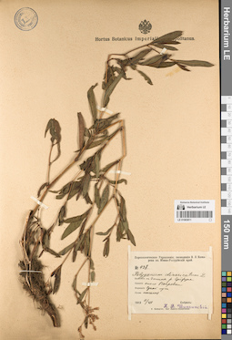
LE 01083811
Groups of specimens: Образцы сектора Сибири и Дальнего Востока РоссииRecord creation: 2023-02-27, Marina Yarichina, PhotoScan D2.Citation: Specimen LE 01083811 // Virtual herbarium of Komarov Botanical Institute RAS — http://re.herbariumle.ru/01083811
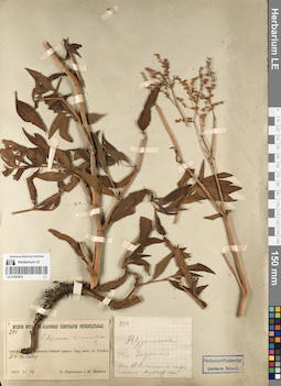
LE 01083810
Groups of specimens: Образцы сектора Сибири и Дальнего Востока РоссииRecord creation: 2023-02-27, Marina Yarichina, PhotoScan D2.Citation: Specimen LE 01083810 // Virtual herbarium of Komarov Botanical Institute RAS — http://re.herbariumle.ru/01083810
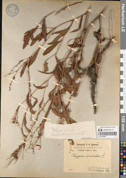
LE 01083809
Groups of specimens: Образцы сектора Сибири и Дальнего Востока РоссииRecord creation: 2023-02-27, Marina Yarichina, PhotoScan D2.Citation: Specimen LE 01083809 // Virtual herbarium of Komarov Botanical Institute RAS — http://re.herbariumle.ru/01083809
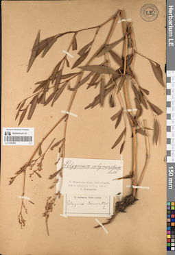
LE 01083808
Groups of specimens: Образцы сектора Сибири и Дальнего Востока РоссииRecord creation: 2023-02-27, Marina Yarichina, PhotoScan D2.Citation: Specimen LE 01083808 // Virtual herbarium of Komarov Botanical Institute RAS — http://re.herbariumle.ru/01083808
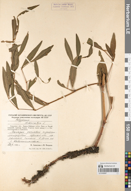
LE 01083807
Groups of specimens: Образцы сектора Сибири и Дальнего Востока РоссииRecord creation: 2023-02-27, Marina Yarichina, PhotoScan D2.Citation: Specimen LE 01083807 // Virtual herbarium of Komarov Botanical Institute RAS — http://re.herbariumle.ru/01083807
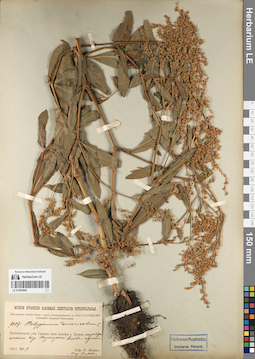
LE 01083806
Groups of specimens: Образцы сектора Сибири и Дальнего Востока РоссииRecord creation: 2023-02-27, Marina Yarichina, PhotoScan D2.Citation: Specimen LE 01083806 // Virtual herbarium of Komarov Botanical Institute RAS — http://re.herbariumle.ru/01083806
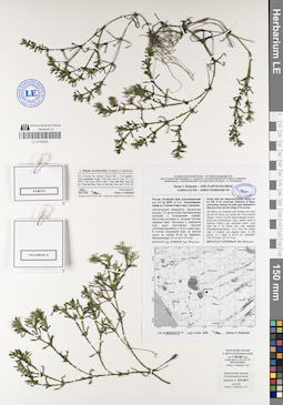
LE 01044506
Najas aculeolata (Tzvelev) A.V. Grebenjuk det. Grebenjuk, Аlexey Viktorovich at 07.2020
Collectors: Grebenjuk, Аlexey Viktorovich Field collecting number: M227KU773. Collection date: 08.07.2020. Administrative regions: RU - Russian Federation; RU - Altayskiy Kray; RU - Altayskiy Kray - Blagoveshchenskiy Rayon. Subregion: Благовещенский район. Топоним: озеро Большая Плотава. Place of collection: между р.п. Степное Озеро и д. Суворовка, в 9.5 км ВЮВ п.г.т. Благовещенка.Expedition: Alexey V. Grebenjuk. Plantae Kulundae ()Groups of specimens: Образцы сектора Сибири и Дальнего Востока России; Соглашение Минобрнауки №075-15-2021-1056; Alexey V. Grebenjuk Coll.; Alexey V. Grebenjuk. Voucher specimens for chromosome countsOriginal label text:Alexey V. Grebenjuk — 2020: Plantae kulundae
ALISMATALES 2020 — NUMERI CHROMOSOMATUM
Россия, Алтайский край, Благовещенский р-н, 9.5 км ВЮВ от п.г.т. Благовещенка, между р.п. Степное Озеро и дер. Суворовка.
Обь-Иртышское междуречье, Центральная Кулунда, 14 км восточнее перешейка между Кучукским и Кулундинским озёрами, бессточная котловина оз. Большая Плотава, западный берег. Чистоводье в прибрежной зоне, вдоль тростниковых зарослей (Hemihalophragmitetum), в 10 м от уреза воды. В стоячей солоноватой воде, на илистом грунте, на глубине 40–50 см, Najadetum. Минерализация 3.37 г/л, pH=7.97–8.02.
52°47'21.61" с.ш., 79°59'45.47" в.д., 110 м н.у.м.
Russia, Altai Krai, Blagoveshchensky District, 9.5 km ESE of the urban-type settlement of Blagoveshchenka, between the urban-type settlement of Stepnoye Ozero and the village of Suvorovka.
SW Siberia, the endorheic plain between the Irtysh and the Ob Rivers, the central part of the Kulunda Steppes, 14 km to E of the isthmus between Kuchukskoye and Kulundinskoye Lakes, western shore of Bolshaya Plotava Lake (endorheic basin). Clear water site in the littoral zone, near reedbeds (Hemihalophragmitetum), 10 m from the water's edge. In brackish and stagnant water, on silty ground, at a depth of 40–50 cm, Najadetum. TDS=3370 ppm, pH=7.97–8.02.
N52°47'21.61" E79°59'45.47" Alt. 110 m a.s.l.
Coll. # M227KU773 Legit 8 Julio 2020 Alexey V. Grebenjuk
Some root-tips removed in situ for chromosome counts.
Specimen coll. nº 20X-M21 fixed in acetic alcohol (1:3) at 13:00–14:00 without pretreatment
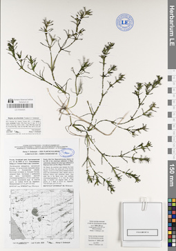
LE 01044505
Najas aculeolata (Tzvelev) A.V. Grebenjuk det. Grebenjuk, Аlexey Viktorovich at 07.2020
Collectors: Grebenjuk, Аlexey Viktorovich Field collecting number: L226KU772. Collection date: 08.07.2020. Administrative regions: RU - Russian Federation; RU - Altayskiy Kray; RU - Altayskiy Kray - Blagoveshchenskiy Rayon. Subregion: Благовещенский район. Топоним: озеро Большая Плотава. Place of collection: между р.п. Степное Озеро и д. Суворовка, в 9.5 км ВЮВ п.г.т. Благовещенка.Expedition: Alexey V. Grebenjuk. Plantae Kulundae ()Groups of specimens: Образцы сектора Сибири и Дальнего Востока России; Соглашение Минобрнауки №075-15-2021-1056; Alexey V. Grebenjuk Coll.; Alexey V. Grebenjuk. Voucher specimens for chromosome countsOriginal label text:Alexey V. Grebenjuk — 2020: Plantae kulundae
ALISMATALES 2020 — NUMERI CHROMOSOMATUM
Россия, Алтайский край, Благовещенский р-н, 9.5 км ВЮВ от п.г.т. Благовещенка, между р.п. Степное Озеро и дер. Суворовка.
Обь-Иртышское междуречье, Центральная Кулунда, 14 км восточнее перешейка между Кучукским и Кулундинским озёрами, бессточная котловина оз. Большая Плотава, западный берег. Чистоводье в прибрежной зоне, вдоль тростниковых зарослей (Hemihalophragmitetum), в 10 м от уреза воды. В стоячей солоноватой воде, на илистом грунте, на глубине 40–50 см, Najadetum. Минерализация 3.37 г/л, pH=7.97–8.02.
52°47'21.61" с.ш., 79°59'45.47" в.д., 110 м н.у.м.
Russia, Altai Krai, Blagoveshchensky District, 9.5 km ESE of the urban-type settlement of Blagoveshchenka, between the urban-type settlement of Stepnoye Ozero and the village of Suvorovka.
SW Siberia, the endorheic plain between the Irtysh and the Ob Rivers, the central part of the Kulunda Steppes, 14 km to E of the isthmus between Kuchukskoye and Kulundinskoye Lakes, western shore of Bolshaya Plotava Lake (endorheic basin). Clear water site in the littoral zone, near reedbeds (Hemihalophragmitetum), 10 m from the water's edge. In brackish and stagnant water, on silty ground, at a depth of 40–50 cm, Najadetum. TDS=3370 ppm, pH=7.97–8.02.
N52°47'21.61" E79°59'45.47" Alt. 110 m a.s.l.
Coll. # L226KU772 Legit 8 Julio 2020 Alexey V. Grebenjuk
Some root-tips removed in situ for chromosome counts.
Specimen coll. nº 20X-L20 fixed in acetic alcohol (1:3) at 13:00–14:00 without pretreatment
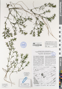
LE 01044504
Najas aculeolata (Tzvelev) A.V. Grebenjuk det. Grebenjuk, Аlexey Viktorovich at 07.2020
Collectors: Grebenjuk, Аlexey Viktorovich Field collecting number: K225KU771. Collection date: 08.07.2020. Administrative regions: RU - Russian Federation; RU - Altayskiy Kray; RU - Altayskiy Kray - Blagoveshchenskiy Rayon. Subregion: Благовещенский район. Топоним: озеро Большая Плотава. Place of collection: между р.п. Степное Озеро и д. Суворовка, в 9.5 км ВЮВ п.г.т. Благовещенка.Expedition: Alexey V. Grebenjuk. Plantae Kulundae ()Groups of specimens: Образцы сектора Сибири и Дальнего Востока России; Соглашение Минобрнауки №075-15-2021-1056Original label text:Alexey V. Grebenjuk — 2020: Plantae kulundae
ALISMATALES 2020 — NUMERI CHROMOSOMATUM
Россия, Алтайский край, Благовещенский р-н, 9.5 км ВЮВ от п.г.т. Благовещенка, между р.п. Степное Озеро и дер. Суворовка.
Обь-Иртышское междуречье, Центральная Кулунда, 14 км восточнее перешейка между Кучукским и Кулундинским озёрами, бессточная котловина оз. Большая Плотава, западный берег. Чистоводье в прибрежной зоне, вдоль тростниковых зарослей (Hemihalophragmitetum), в 10 м от уреза воды. В стоячей солоноватой воде, на илистом грунте, на глубине 40–50 см, Najadetum. Минерализация 3.37 г/л, pH=7.97–8.02.
52°47'21.61" с.ш., 79°59'45.47" в.д., 110 м н.у.м.
Russia, Altai Krai, Blagoveshchensky District, 9.5 km ESE of the urban-type settlement of Blagoveshchenka, between the urban-type settlement of Stepnoye Ozero and the village of Suvorovka.
SW Siberia, the endorheic plain between the Irtysh and the Ob Rivers, the central part of the Kulunda Steppes, 14 km to E of the isthmus between Kuchukskoye and Kulundinskoye Lakes, western shore of Bolshaya Plotava Lake (endorheic basin). Clear water site in the littoral zone, near reedbeds (Hemihalophragmitetum), 10 m from the water's edge. In brackish and stagnant water, on silty ground, at a depth of 40–50 cm, Najadetum. TDS=3370 ppm, pH=7.97–8.02.
N52°47'21.61" E79°59'45.47" Alt. 110 m a.s.l.
Coll. # K225KU771 Legit 8 Julio 2020 Alexey V. Grebenjuk
Some root-tips removed in situ for chromosome counts.
Specimen coll. nº 20X-K19 fixed in acetic alcohol (1:3) at 13:00–14:00 without pretreatment
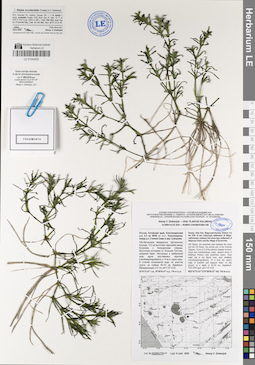
LE 01044503
Najas aculeolata (Tzvelev) A.V. Grebenjuk det. Grebenjuk, Аlexey Viktorovich at 07.2020
Collectors: Grebenjuk, Аlexey Viktorovich Field collecting number: K225KU770. Collection date: 08.07.2020. Administrative regions: RU - Russian Federation; RU - Altayskiy Kray; RU - Altayskiy Kray - Blagoveshchenskiy Rayon. Subregion: Благовещенский район. Топоним: озеро Большая Плотава. Place of collection: между р.п. Степное Озеро и д. Суворовка, в 9.5 км ВЮВ п.г.т. Благовещенка.Expedition: Alexey V. Grebenjuk. Plantae Kulundae ()Groups of specimens: Образцы сектора Сибири и Дальнего Востока России; Соглашение Минобрнауки №075-15-2021-1056Original label text:Alexey V. Grebenjuk — 2020: Plantae kulundae
ALISMATALES 2020 — NUMERI CHROMOSOMATUM
Россия, Алтайский край, Благовещенский р-н, 9.5 км ВЮВ от п.г.т. Благовещенка, между р.п. Степное Озеро и дер. Суворовка.
Обь-Иртышское междуречье, Центральная Кулунда, 14 км восточнее перешейка между Кучукским и Кулундинским озёрами, бессточная котловина оз. Большая Плотава, западный берег. Чистоводье в прибрежной зоне, вдоль тростниковых зарослей (Hemihalophragmitetum), в 10 м от уреза воды. В стоячей солоноватой воде, на илистом грунте, на глубине 40–50 см, Najadetum. Минерализация 3.37 г/л, pH=7.97–8.02.
52°47'21.61" с.ш., 79°59'45.47" в.д., 110 м н.у.м.
Russia, Altai Krai, Blagoveshchensky District, 9.5 km ESE of the urban-type settlement of Blagoveshchenka, between the urban-type settlement of Stepnoye Ozero and the village of Suvorovka.
SW Siberia, the endorheic plain between the Irtysh and the Ob Rivers, the central part of the Kulunda Steppes, 14 km to E of the isthmus between Kuchukskoye and Kulundinskoye Lakes, western shore of Bolshaya Plotava Lake (endorheic basin). Clear water site in the littoral zone, near reedbeds (Hemihalophragmitetum), 10 m from the water's edge. In brackish and stagnant water, on silty ground, at a depth of 40–50 cm, Najadetum. TDS=3370 ppm, pH=7.97–8.02.
N52°47'21.61" E79°59'45.47" Alt. 110 m a.s.l.
Coll. # K225KU770 Legit 8 Julio 2020 Alexey V. Grebenjuk
Some root-tips removed in situ for chromosome counts.
Specimen coll. nº 20X-K19 fixed in acetic alcohol (1:3) at 13:00–14:00 without pretreatment
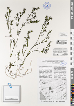
LE 01044502
Najas aculeolata (Tzvelev) A.V. Grebenjuk det. Grebenjuk, Аlexey Viktorovich at 07.2020
Collectors: Grebenjuk, Аlexey Viktorovich Field collecting number: I224KU769. Collection date: 08.07.2020. Administrative regions: RU - Russian Federation; RU - Altayskiy Kray; RU - Altayskiy Kray - Blagoveshchenskiy Rayon. Subregion: Благовещенский район. Топоним: озеро Большая Плотава. Place of collection: между р.п. Степное Озеро и д. Суворовка, в 9.5 км ВЮВ п.г.т. Благовещенка.Expedition: Alexey V. Grebenjuk. Plantae Kulundae ()Groups of specimens: Образцы сектора Сибири и Дальнего Востока России; Соглашение Минобрнауки №075-15-2021-1056Original label text:Alexey V. Grebenjuk — 2020: Plantae kulundae
ALISMATALES 2020 — NUMERI CHROMOSOMATUM
Россия, Алтайский край, Благовещенский р-н, 9.5 км ВЮВ от п.г.т. Благовещенка, между р.п. Степное Озеро и дер. Суворовка.
Обь-Иртышское междуречье, Центральная Кулунда, 14 км восточнее перешейка между Кучукским и Кулундинским озёрами, бессточная котловина оз. Большая Плотава, западный берег. Чистоводье в прибрежной зоне, вдоль тростниковых зарослей (Hemihalophragmitetum), в 10 м от уреза воды. В стоячей солоноватой воде, на илистом грунте, на глубине 40–50 см, Najadetum. Минерализация 3.37 г/л, pH=7.97–8.02.
52°47'21.61" с.ш., 79°59'45.47" в.д., 110 м н.у.м.
Russia, Altai Krai, Blagoveshchensky District, 9.5 km ESE of the urban-type settlement of Blagoveshchenka, between the urban-type settlement of Stepnoye Ozero and the village of Suvorovka.
SW Siberia, the endorheic plain between the Irtysh and the Ob Rivers, the central part of the Kulunda Steppes, 14 km to E of the isthmus between Kuchukskoye and Kulundinskoye Lakes, western shore of Bolshaya Plotava Lake (endorheic basin). Clear water site in the littoral zone, near reedbeds (Hemihalophragmitetum), 10 m from the water's edge. In brackish and stagnant water, on silty ground, at a depth of 40–50 cm, Najadetum. TDS=3370 ppm, pH=7.97–8.02.
N52°47'21.61" E79°59'45.47" Alt. 110 m a.s.l.
Coll. # I224KU769 Legit 8 Julio 2020 Alexey V. Grebenjuk
Some root-tips removed in situ for chromosome counts.
Specimen coll. nº 20X-I18 fixed in acetic alcohol (1:3) at 13:00–14:00 without pretreatment
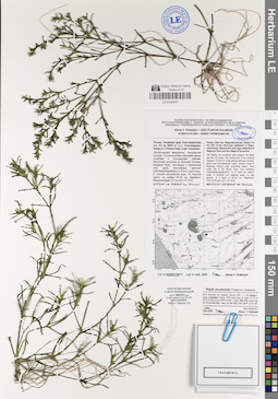
LE 01044501
Najas aculeolata (Tzvelev) A.V. Grebenjuk det. Grebenjuk, Аlexey Viktorovich at 07.2020
Collectors: Grebenjuk, Аlexey Viktorovich Field collecting number: H223KU768. Collection date: 08.07.2020. Administrative regions: RU - Russian Federation; RU - Altayskiy Kray; RU - Altayskiy Kray - Blagoveshchenskiy Rayon. Subregion: Благовещенский район. Топоним: озеро Большая Плотава. Place of collection: между р.п. Степное Озеро и д. Суворовка, в 9.5 км ВЮВ п.г.т. Благовещенка.Expedition: Alexey V. Grebenjuk. Plantae Kulundae ()Groups of specimens: Образцы сектора Сибири и Дальнего Востока России; Соглашение Минобрнауки №075-15-2021-1056Original label text:Alexey V. Grebenjuk — 2020: Plantae kulundae
ALISMATALES 2020 — NUMERI CHROMOSOMATUM
Россия, Алтайский край, Благовещенский р-н, 9.5 км ВЮВ от п.г.т. Благовещенка, между р.п. Степное Озеро и дер. Суворовка.
Обь-Иртышское междуречье, Центральная Кулунда, 14 км восточнее перешейка между Кучукским и Кулундинским озёрами, бессточная котловина оз. Большая Плотава, западный берег. Чистоводье в прибрежной зоне, вдоль тростниковых зарослей (Hemihalophragmitetum), в 10 м от уреза воды. В стоячей солоноватой воде, на илистом грунте, на глубине 40–50 см, Najadetum. Минерализация 3.37 г/л, pH=7.97–8.02.
52°47'21.61" с.ш., 79°59'45.47" в.д., 110 м н.у.м.
Russia, Altai Krai, Blagoveshchensky District, 9.5 km ESE of the urban-type settlement of Blagoveshchenka, between the urban-type settlement of Stepnoye Ozero and the village of Suvorovka.
SW Siberia, the endorheic plain between the Irtysh and the Ob Rivers, the central part of the Kulunda Steppes, 14 km to E of the isthmus between Kuchukskoye and Kulundinskoye Lakes, western shore of Bolshaya Plotava Lake (endorheic basin). Clear water site in the littoral zone, near reedbeds (Hemihalophragmitetum), 10 m from the water's edge. In brackish and stagnant water, on silty ground, at a depth of 40–50 cm, Najadetum. TDS=3370 ppm, pH=7.97–8.02.
N52°47'21.61" E79°59'45.47" Alt. 110 m a.s.l.
Coll. # H223KU768 Legit 8 Julio 2020 Alexey V. Grebenjuk
Some root-tips removed in situ for chromosome counts.
Specimen coll. nº 20X-H17 fixed in acetic alcohol (1:3) at 13:00–14:00 without pretreatment
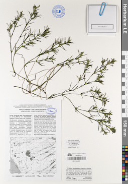
LE 01044500
Najas aculeolata (Tzvelev) A.V. Grebenjuk det. Grebenjuk, Аlexey Viktorovich at 07.2020
Collectors: Grebenjuk, Аlexey Viktorovich Field collecting number: H223KU767. Collection date: 08.07.2020. Administrative regions: RU - Russian Federation; RU - Altayskiy Kray; RU - Altayskiy Kray - Blagoveshchenskiy Rayon. Subregion: Благовещенский район. Топоним: озеро Большая Плотава. Place of collection: между р.п. Степное Озеро и д. Суворовка, в 9.5 км ВЮВ п.г.т. Благовещенка.Expedition: Alexey V. Grebenjuk. Plantae Kulundae ()Groups of specimens: Образцы сектора Сибири и Дальнего Востока России; Соглашение Минобрнауки №075-15-2021-1056Original label text:Alexey V. Grebenjuk — 2020: Plantae kulundae
ALISMATALES 2020 — NUMERI CHROMOSOMATUM
Россия, Алтайский край, Благовещенский р-н, 9.5 км ВЮВ от п.г.т. Благовещенка, между р.п. Степное Озеро и дер. Суворовка.
Обь-Иртышское междуречье, Центральная Кулунда, 14 км восточнее перешейка между Кучукским и Кулундинским озёрами, бессточная котловина оз. Большая Плотава, западный берег. Чистоводье в прибрежной зоне, вдоль тростниковых зарослей (Hemihalophragmitetum), в 10 м от уреза воды. В стоячей солоноватой воде, на илистом грунте, на глубине 40–50 см, Najadetum. Минерализация 3.37 г/л, pH=7.97–8.02.
52°47'21.61" с.ш., 79°59'45.47" в.д., 110 м н.у.м.
Russia, Altai Krai, Blagoveshchensky District, 9.5 km ESE of the urban-type settlement of Blagoveshchenka, between the urban-type settlement of Stepnoye Ozero and the village of Suvorovka.
SW Siberia, the endorheic plain between the Irtysh and the Ob Rivers, the central part of the Kulunda Steppes, 14 km to E of the isthmus between Kuchukskoye and Kulundinskoye Lakes, western shore of Bolshaya Plotava Lake (endorheic basin). Clear water site in the littoral zone, near reedbeds (Hemihalophragmitetum), 10 m from the water's edge. In brackish and stagnant water, on silty ground, at a depth of 40–50 cm, Najadetum. TDS=3370 ppm, pH=7.97–8.02.
N52°47'21.61" E79°59'45.47" Alt. 110 m a.s.l.
Coll. # H223KU767 Legit 8 Julio 2020 Alexey V. Grebenjuk
Some root-tips removed in situ for chromosome counts.
Specimen coll. nº 20X-H17 fixed in acetic alcohol (1:3) at 13:00–14:00 without pretreatment
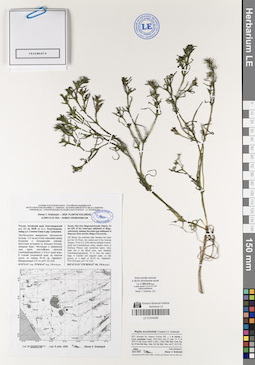
LE 01044499
Najas aculeolata (Tzvelev) A.V. Grebenjuk det. Grebenjuk, Аlexey Viktorovich at 07.2020
Collectors: Grebenjuk, Аlexey Viktorovich Field collecting number: G222KU766. Collection date: 08.07.2020. Administrative regions: RU - Russian Federation; RU - Altayskiy Kray; RU - Altayskiy Kray - Blagoveshchenskiy Rayon. Subregion: Благовещенский район. Топоним: озеро Большая Плотава. Place of collection: между р.п. Степное Озеро и д. Суворовка, в 9.5 км ВЮВ п.г.т. Благовещенка.Expedition: Alexey V. Grebenjuk. Plantae Kulundae ()Groups of specimens: Образцы сектора Сибири и Дальнего Востока России; Соглашение Минобрнауки №075-15-2021-1056Original label text:Alexey V. Grebenjuk — 2020: Plantae kulundae
ALISMATALES 2020 — NUMERI CHROMOSOMATUM
Россия, Алтайский край, Благовещенский р-н, 9.5 км ВЮВ от п.г.т. Благовещенка, между р.п. Степное Озеро и дер. Суворовка.
Обь-Иртышское междуречье, Центральная Кулунда, 14 км восточнее перешейка между Кучукским и Кулундинским озёрами, бессточная котловина оз. Большая Плотава, западный берег. Чистоводье в прибрежной зоне, вдоль тростниковых зарослей (Hemihalophragmitetum), в 10 м от уреза воды. В стоячей солоноватой воде, на илистом грунте, на глубине 40–50 см, Najadetum. Минерализация 3.37 г/л, pH=7.97–8.02.
52°47'21.61" с.ш., 79°59'45.47" в.д., 110 м н.у.м.
Russia, Altai Krai, Blagoveshchensky District, 9.5 km ESE of the urban-type settlement of Blagoveshchenka, between the urban-type settlement of Stepnoye Ozero and the village of Suvorovka.
SW Siberia, the endorheic plain between the Irtysh and the Ob Rivers, the central part of the Kulunda Steppes, 14 km to E of the isthmus between Kuchukskoye and Kulundinskoye Lakes, western shore of Bolshaya Plotava Lake (endorheic basin). Clear water site in the littoral zone, near reedbeds (Hemihalophragmitetum), 10 m from the water's edge. In brackish and stagnant water, on silty ground, at a depth of 40–50 cm, Najadetum. TDS=3370 ppm, pH=7.97–8.02.
N52°47'21.61" E79°59'45.47" Alt. 110 m a.s.l.
Coll. # G222KU766 Legit 8 Julio 2020 Alexey V. Grebenjuk
Some root-tips removed in situ for chromosome counts.
Specimen coll. nº 20X-G16 fixed in acetic alcohol (1:3) at 13:00–14:00 without pretreatment
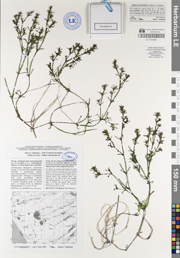
LE 01044498
Najas aculeolata (Tzvelev) A.V. Grebenjuk det. Grebenjuk, Аlexey Viktorovich at 07.2020
Collectors: Grebenjuk, Аlexey Viktorovich Field collecting number: F221KU765. Collection date: 08.07.2020. Administrative regions: RU - Russian Federation; RU - Altayskiy Kray; RU - Altayskiy Kray - Blagoveshchenskiy Rayon. Subregion: Благовещенский район. Топоним: озеро Большая Плотава. Place of collection: между р.п. Степное Озеро и д. Суворовка, в 9.5 км ВЮВ п.г.т. Благовещенка.Expedition: Alexey V. Grebenjuk. Plantae Kulundae ()Groups of specimens: Образцы сектора Сибири и Дальнего Востока России; Соглашение Минобрнауки №075-15-2021-1056Original label text:Alexey V. Grebenjuk — 2020: Plantae kulundae
ALISMATALES 2020 — NUMERI CHROMOSOMATUM
Россия, Алтайский край, Благовещенский р-н, 9.5 км ВЮВ от п.г.т. Благовещенка, между р.п. Степное Озеро и дер. Суворовка.
Обь-Иртышское междуречье, Центральная Кулунда, 14 км восточнее перешейка между Кучукским и Кулундинским озёрами, бессточная котловина оз. Большая Плотава, западный берег. Чистоводье в прибрежной зоне, вдоль тростниковых зарослей (Hemihalophragmitetum), в 10 м от уреза воды. В стоячей солоноватой воде, на илистом грунте, на глубине 40–50 см, Najadetum. Минерализация 3.37 г/л, pH=7.97–8.02.
52°47'21.61" с.ш., 79°59'45.47" в.д., 110 м н.у.м.
Russia, Altai Krai, Blagoveshchensky District, 9.5 km ESE of the urban-type settlement of Blagoveshchenka, between the urban-type settlement of Stepnoye Ozero and the village of Suvorovka.
SW Siberia, the endorheic plain between the Irtysh and the Ob Rivers, the central part of the Kulunda Steppes, 14 km to E of the isthmus between Kuchukskoye and Kulundinskoye Lakes, western shore of Bolshaya Plotava Lake (endorheic basin). Clear water site in the littoral zone, near reedbeds (Hemihalophragmitetum), 10 m from the water's edge. In brackish and stagnant water, on silty ground, at a depth of 40–50 cm, Najadetum. TDS=3370 ppm, pH=7.97–8.02.
N52°47'21.61" E79°59'45.47" Alt. 110 m a.s.l.
Coll. # F221KU765 Legit 8 Julio 2020 Alexey V. Grebenjuk
Some root-tips removed in situ for chromosome counts.
Specimen coll. nº 20X-F15 fixed in acetic alcohol (1:3) at 13:00–14:00 without pretreatment
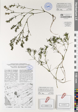
LE 01044497
Najas aculeolata (Tzvelev) A.V. Grebenjuk det. Grebenjuk, Аlexey Viktorovich at 07.2020
Collectors: Grebenjuk, Аlexey Viktorovich Field collecting number: F221KU764. Collection date: 08.07.2020. Administrative regions: RU - Russian Federation; RU - Altayskiy Kray; RU - Altayskiy Kray - Blagoveshchenskiy Rayon. Subregion: Благовещенский район. Топоним: озеро Большая Плотава. Place of collection: между р.п. Степное Озеро и д. Суворовка, в 9.5 км ВЮВ п.г.т. Благовещенка.Expedition: Alexey V. Grebenjuk. Plantae Kulundae ()Groups of specimens: Образцы сектора Сибири и Дальнего Востока России; Соглашение Минобрнауки №075-15-2021-1056Original label text:Alexey V. Grebenjuk — 2020: Plantae kulundae
ALISMATALES 2020 — NUMERI CHROMOSOMATUM
Россия, Алтайский край, Благовещенский р-н, 9.5 км ВЮВ от п.г.т. Благовещенка, между р.п. Степное Озеро и дер. Суворовка.
Обь-Иртышское междуречье, Центральная Кулунда, 14 км восточнее перешейка между Кучукским и Кулундинским озёрами, бессточная котловина оз. Большая Плотава, западный берег. Чистоводье в прибрежной зоне, вдоль тростниковых зарослей (Hemihalophragmitetum), в 10 м от уреза воды. В стоячей солоноватой воде, на илистом грунте, на глубине 40–50 см, Najadetum. Минерализация 3.37 г/л, pH=7.97–8.02.
52°47'21.61" с.ш., 79°59'45.47" в.д., 110 м н.у.м.
Russia, Altai Krai, Blagoveshchensky District, 9.5 km ESE of the urban-type settlement of Blagoveshchenka, between the urban-type settlement of Stepnoye Ozero and the village of Suvorovka.
SW Siberia, the endorheic plain between the Irtysh and the Ob Rivers, the central part of the Kulunda Steppes, 14 km to E of the isthmus between Kuchukskoye and Kulundinskoye Lakes, western shore of Bolshaya Plotava Lake (endorheic basin). Clear water site in the littoral zone, near reedbeds (Hemihalophragmitetum), 10 m from the water's edge. In brackish and stagnant water, on silty ground, at a depth of 40–50 cm, Najadetum. TDS=3370 ppm, pH=7.97–8.02.
N52°47'21.61" E79°59'45.47" Alt. 110 m a.s.l.
Coll. # F221KU764 Legit 8 Julio 2020 Alexey V. Grebenjuk
Some root-tips removed in situ for chromosome counts.
Specimen coll. nº 20X-F15 fixed in acetic alcohol (1:3) at 13:00–14:00 without pretreatment
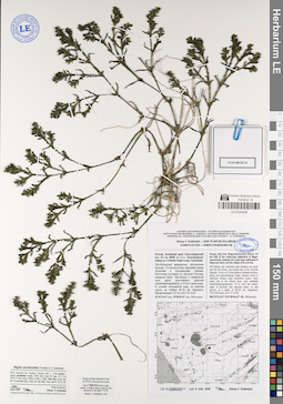
LE 01044496
Najas aculeolata (Tzvelev) A.V. Grebenjuk det. Grebenjuk, Аlexey Viktorovich at 07.2020
Collectors: Grebenjuk, Аlexey Viktorovich Field collecting number: E220KU763. Collection date: 08.07.2020. Administrative regions: RU - Russian Federation; RU - Altayskiy Kray; RU - Altayskiy Kray - Blagoveshchenskiy Rayon. Subregion: Благовещенский район. Топоним: озеро Большая Плотава. Place of collection: между р.п. Степное Озеро и д. Суворовка, в 9.5 км ВЮВ п.г.т. Благовещенка.Expedition: Alexey V. Grebenjuk. Plantae Kulundae ()Groups of specimens: Образцы сектора Сибири и Дальнего Востока России; Соглашение Минобрнауки №075-15-2021-1056Original label text:Alexey V. Grebenjuk — 2020: Plantae kulundae
ALISMATALES 2020 — NUMERI CHROMOSOMATUM
Россия, Алтайский край, Благовещенский р-н, 9.5 км ВЮВ от п.г.т. Благовещенка, между р.п. Степное Озеро и дер. Суворовка.
Обь-Иртышское междуречье, Центральная Кулунда, 14 км восточнее перешейка между Кучукским и Кулундинским озёрами, бессточная котловина оз. Большая Плотава, западный берег. Чистоводье в прибрежной зоне, вдоль тростниковых зарослей (Hemihalophragmitetum), в 10 м от уреза воды. В стоячей солоноватой воде, на илистом грунте, на глубине 40–50 см, Najadetum. Минерализация 3.37 г/л, pH=7.97–8.02.
52°47'21.61" с.ш., 79°59'45.47" в.д., 110 м н.у.м.
Russia, Altai Krai, Blagoveshchensky District, 9.5 km ESE of the urban-type settlement of Blagoveshchenka, between the urban-type settlement of Stepnoye Ozero and the village of Suvorovka.
SW Siberia, the endorheic plain between the Irtysh and the Ob Rivers, the central part of the Kulunda Steppes, 14 km to E of the isthmus between Kuchukskoye and Kulundinskoye Lakes, western shore of Bolshaya Plotava Lake (endorheic basin). Clear water site in the littoral zone, near reedbeds (Hemihalophragmitetum), 10 m from the water's edge. In brackish and stagnant water, on silty ground, at a depth of 40–50 cm, Najadetum. TDS=3370 ppm, pH=7.97–8.02.
N52°47'21.61" E79°59'45.47" Alt. 110 m a.s.l.
Coll. # E220KU763 Legit 8 Julio 2020 Alexey V. Grebenjuk
Some root-tips removed in situ at 15:00 for chromosome counts.
Specimen coll. nº 20X-E14 fixed in acetic alcohol (1:3) after cooling in water for 24h (exposure to cold water 0º–+2ºC)
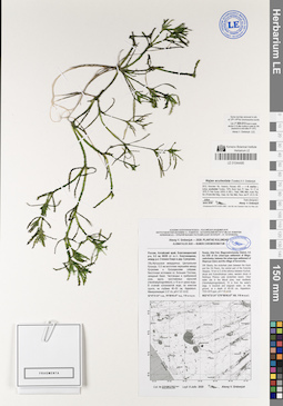
LE 01044495
Najas aculeolata (Tzvelev) A.V. Grebenjuk det. Grebenjuk, Аlexey Viktorovich at 07.2020
Collectors: Grebenjuk, Аlexey Viktorovich Field collecting number: D219KU762. Collection date: 08.07.2020. Administrative regions: RU - Russian Federation; RU - Altayskiy Kray; RU - Altayskiy Kray - Blagoveshchenskiy Rayon. Subregion: Благовещенский район. Топоним: озеро Большая Плотава. Place of collection: между р.п. Степное Озеро и д. Суворовка, в 9.5 км ВЮВ п.г.т. Благовещенка.Expedition: Alexey V. Grebenjuk. Plantae Kulundae ()Groups of specimens: Образцы сектора Сибири и Дальнего Востока России; Соглашение Минобрнауки №075-15-2021-1056Original label text:Alexey V. Grebenjuk — 2020: Plantae kulundae
ALISMATALES 2020 — NUMERI CHROMOSOMATUM
Россия, Алтайский край, Благовещенский р-н, 9.5 км ВЮВ от п.г.т. Благовещенка, между р.п. Степное Озеро и дер. Суворовка.
Обь-Иртышское междуречье, Центральная Кулунда, 14 км восточнее перешейка между Кучукским и Кулундинским озёрами, бессточная котловина оз. Большая Плотава, западный берег. Чистоводье в прибрежной зоне, вдоль тростниковых зарослей (Hemihalophragmitetum), в 10 м от уреза воды. В стоячей солоноватой воде, на илистом грунте, на глубине 40–50 см, Najadetum. Минерализация 3.37 г/л, pH=7.97–8.02.
52°47'21.61" с.ш., 79°59'45.47" в.д., 110 м н.у.м.
Russia, Altai Krai, Blagoveshchensky District, 9.5 km ESE of the urban-type settlement of Blagoveshchenka, between the urban-type settlement of Stepnoye Ozero and the village of Suvorovka.
SW Siberia, the endorheic plain between the Irtysh and the Ob Rivers, the central part of the Kulunda Steppes, 14 km to E of the isthmus between Kuchukskoye and Kulundinskoye Lakes, western shore of Bolshaya Plotava Lake (endorheic basin). Clear water site in the littoral zone, near reedbeds (Hemihalophragmitetum), 10 m from the water's edge. In brackish and stagnant water, on silty ground, at a depth of 40–50 cm, Najadetum. TDS=3370 ppm, pH=7.97–8.02.
N52°47'21.61" E79°59'45.47" Alt. 110 m a.s.l.
Coll. # D219KU762 Legit 8 Julio 2020 Alexey V. Grebenjuk
Some root-tips removed in situ at 13:00–14:00 for chromosome counts.
Specimen coll. nº 20X-D13 fixed in acetic alcohol (1:3) after cooling in water for 24h (exposure to cold water 0º–+2ºC)
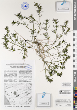
LE 01044494
Najas aculeolata (Tzvelev) A.V. Grebenjuk det. Grebenjuk, Аlexey Viktorovich at 07.2020
Collectors: Grebenjuk, Аlexey Viktorovich Field collecting number: C218KU761. Collection date: 08.07.2020. Administrative regions: RU - Russian Federation; RU - Altayskiy Kray; RU - Altayskiy Kray - Blagoveshchenskiy Rayon. Subregion: Благовещенский район. Топоним: озеро Большая Плотава. Place of collection: между р.п. Степное Озеро и д. Суворовка, в 9.5 км ВЮВ п.г.т. Благовещенка.Expedition: Alexey V. Grebenjuk. Plantae Kulundae ()Groups of specimens: Образцы сектора Сибири и Дальнего Востока России; Соглашение Минобрнауки №075-15-2021-1056Original label text:Alexey V. Grebenjuk — 2020: Plantae kulundae
ALISMATALES 2020 — NUMERI CHROMOSOMATUM
Россия, Алтайский край, Благовещенский р-н, 9.5 км ВЮВ от п.г.т. Благовещенка, между р.п. Степное Озеро и дер. Суворовка.
Обь-Иртышское междуречье, Центральная Кулунда, 14 км восточнее перешейка между Кучукским и Кулундинским озёрами, бессточная котловина оз. Большая Плотава, западный берег. Чистоводье в прибрежной зоне, вдоль тростниковых зарослей (Hemihalophragmitetum), в 10 м от уреза воды. В стоячей солоноватой воде, на илистом грунте, на глубине 40–50 см, Najadetum. Минерализация 3.37 г/л, pH=7.97–8.02.
52°47'21.61" с.ш., 79°59'45.47" в.д., 110 м н.у.м.
Russia, Altai Krai, Blagoveshchensky District, 9.5 km ESE of the urban-type settlement of Blagoveshchenka, between the urban-type settlement of Stepnoye Ozero and the village of Suvorovka.
SW Siberia, the endorheic plain between the Irtysh and the Ob Rivers, the central part of the Kulunda Steppes, 14 km to E of the isthmus between Kuchukskoye and Kulundinskoye Lakes, western shore of Bolshaya Plotava Lake (endorheic basin). Clear water site in the littoral zone, near reedbeds (Hemihalophragmitetum), 10 m from the water's edge. In brackish and stagnant water, on silty ground, at a depth of 40–50 cm, Najadetum. TDS=3370 ppm, pH=7.97–8.02.
N52°47'21.61" E79°59'45.47" Alt. 110 m a.s.l.
Coll. # C218KU761 Legit 8 Julio 2020 Alexey V. Grebenjuk
Some root-tips removed in situ at 13:00–14:00 for chromosome counts.
Specimen coll. nº 20X-C12 fixed in acetic alcohol (1:3) after cooling in water for 24h (exposure to cold water 0º–+2ºC)
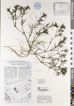
LE 01044493
Najas aculeolata (Tzvelev) A.V. Grebenjuk det. Grebenjuk, Аlexey Viktorovich at 07.2020
Collectors: Grebenjuk, Аlexey Viktorovich Field collecting number: B217KU760. Collection date: 08.07.2020. Administrative regions: RU - Russian Federation; RU - Altayskiy Kray; RU - Altayskiy Kray - Blagoveshchenskiy Rayon. Subregion: Благовещенский район. Топоним: озеро Большая Плотава. Place of collection: между р.п. Степное Озеро и д. Суворовка, в 9.5 км ВЮВ п.г.т. Благовещенка.Expedition: Alexey V. Grebenjuk. Plantae Kulundae ()Groups of specimens: Образцы сектора Сибири и Дальнего Востока России; Соглашение Минобрнауки №075-15-2021-1056Original label text:Alexey V. Grebenjuk — 2020: Plantae kulundae
ALISMATALES 2020 — NUMERI CHROMOSOMATUM
Россия, Алтайский край, Благовещенский р-н, 9.5 км ВЮВ от п.г.т. Благовещенка, между р.п. Степное Озеро и дер. Суворовка.
Обь-Иртышское междуречье, Центральная Кулунда, 14 км восточнее перешейка между Кучукским и Кулундинским озёрами, бессточная котловина оз. Большая Плотава, западный берег. Чистоводье в прибрежной зоне, вдоль тростниковых зарослей (Hemihalophragmitetum), в 10 м от уреза воды. В стоячей солоноватой воде, на илистом грунте, на глубине 40–50 см, Najadetum. Минерализация 3.37 г/л, pH=7.97–8.02.
52°47'21.61" с.ш., 79°59'45.47" в.д., 110 м н.у.м.
Russia, Altai Krai, Blagoveshchensky District, 9.5 km ESE of the urban-type settlement of Blagoveshchenka, between the urban-type settlement of Stepnoye Ozero and the village of Suvorovka.
SW Siberia, the endorheic plain between the Irtysh and the Ob Rivers, the central part of the Kulunda Steppes, 14 km to E of the isthmus between Kuchukskoye and Kulundinskoye Lakes, western shore of Bolshaya Plotava Lake (endorheic basin). Clear water site in the littoral zone, near reedbeds (Hemihalophragmitetum), 10 m from the water's edge. In brackish and stagnant water, on silty ground, at a depth of 40–50 cm, Najadetum. TDS=3370 ppm, pH=7.97–8.02.
N52°47'21.61" E79°59'45.47" Alt. 110 m a.s.l.
Coll. # B217KU760 Legit 8 Julio 2020 Alexey V. Grebenjuk
Some root-tips removed in situ at 13:00–14:00 for chromosome counts.
Specimen coll. nº 20X-B11 fixed in acetic alcohol (1:3) after cooling in water for 24h (exposure to cold water 0º–+2ºC)
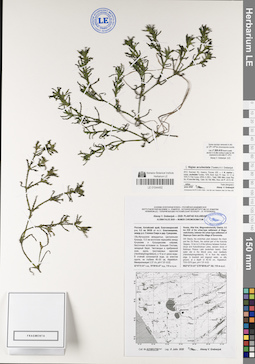
LE 01044492
Najas aculeolata (Tzvelev) A.V. Grebenjuk det. Grebenjuk, Аlexey Viktorovich at 07.2020
Collectors: Grebenjuk, Аlexey Viktorovich Field collecting number: A216KU759. Collection date: 08.07.2020. Administrative regions: RU - Russian Federation; RU - Altayskiy Kray; RU - Altayskiy Kray - Blagoveshchenskiy Rayon. Subregion: Благовещенский район. Топоним: озеро Большая Плотава. Place of collection: между р.п. Степное Озеро и д. Суворовка, в 9.5 км ВЮВ п.г.т. Благовещенка.Expedition: Alexey V. Grebenjuk. Plantae Kulundae ()Groups of specimens: Образцы сектора Сибири и Дальнего Востока России; Соглашение Минобрнауки №075-15-2021-1056Original label text:Alexey V. Grebenjuk — 2020: Plantae kulundae
ALISMATALES 2020 — NUMERI CHROMOSOMATUM
Россия, Алтайский край, Благовещенский р-н, 9.5 км ВЮВ от п.г.т. Благовещенка, между р.п. Степное Озеро и дер. Суворовка.
Обь-Иртышское междуречье, Центральная Кулунда, 14 км восточнее перешейка между Кучукским и Кулундинским озёрами, бессточная котловина оз. Большая Плотава, западный берег. Чистоводье в прибрежной зоне, вдоль тростниковых зарослей (Hemihalophragmitetum), в 10 м от уреза воды. В стоячей солоноватой воде, на илистом грунте, на глубине 40–50 см, Najadetum. Минерализация 3.37 г/л, pH=7.97–8.02.
52°47'21.61" с.ш., 79°59'45.47" в.д., 110 м н.у.м.
Russia, Altai Krai, Blagoveshchensky District, 9.5 km ESE of the urban-type settlement of Blagoveshchenka, between the urban-type settlement of Stepnoye Ozero and the village of Suvorovka.
SW Siberia, the endorheic plain between the Irtysh and the Ob Rivers, the central part of the Kulunda Steppes, 14 km to E of the isthmus between Kuchukskoye and Kulundinskoye Lakes, western shore of Bolshaya Plotava Lake (endorheic basin). Clear water site in the littoral zone, near reedbeds (Hemihalophragmitetum), 10 m from the water's edge. In brackish and stagnant water, on silty ground, at a depth of 40–50 cm, Najadetum. TDS=3370 ppm, pH=7.97–8.02.
N52°47'21.61" E79°59'45.47" Alt. 110 m a.s.l.
Coll. # A216KU759 Legit 8 Julio 2020 Alexey V. Grebenjuk
Some root-tips removed in situ at 13:00–14:00 for chromosome counts.
Specimen coll. nº 20X-A10 fixed in acetic alcohol (1:3) after cooling in water for 24h (exposure to cold water 0º–+2ºC)
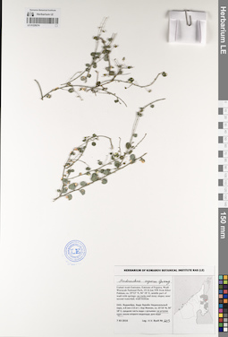
LE 01229274
Andrachne aspera Spreng. det. Byalt, Vyacheslav Vyacheslavovich
Administrative regions: AE - Al Fujayrah. Groups of specimens: Образцы общего сектора; Соглашение Минобрнауки №075-15-2021-1056Record creation: 2023-02-24, Denis Melnikov, PhotoScan D2.Citation: Specimen LE 01229274 // Virtual herbarium of Komarov Botanical Institute RAS — http://re.herbariumle.ru/01229274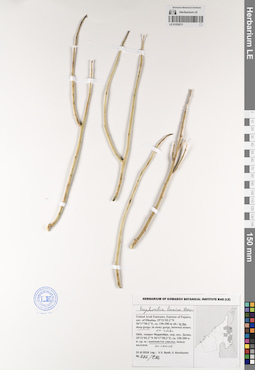
LE 01229273
Euphorbia larica Boiss. det. Byalt, Vyacheslav Vyacheslavovich
Collectors: Byalt, Vyacheslav Vyacheslavovich; Korshunov, Vladimir Mikhailovich Field collecting number: 796/286. Collection date: 31.03.2018. Administrative regions: AE - United Arab Emirates. Place of collection: эмират Фуджейра, окрестности пос. Дадна, глубокое ущелье, на скале.Groups of specimens: Образцы общего сектора; Соглашение Минобрнауки №075-15-2021-1056; Бялт В.В.: Флора ФуджейрыOriginal label text: United Arab Emirates. Emirate of Fujaira, env. of Dhadna, 25°31'02.2"N 56°17'50.2"E, ca. 150–200 m alt.: in the deep gorge; on rocks. – ОАЭ, эмират Фуджейра, окр. пос. Дадна, 25°31'02.2"N 56°17'50.2"E, ca. 150–200 м н. ур. м.: каменистое ущелье, на скале, 31 III 2018, V.V. Byalt, V.M. Korshunov
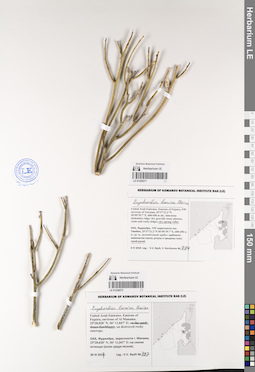
LE 01229271
Euphorbia larica Boiss. det. Byalt, Vyacheslav Vyacheslavovich
Collectors: Byalt, Vyacheslav Vyacheslavovich Field collecting number: 794. Collection date: 06.04.2018. Administrative regions: AE - United Arab Emirates. Place of collection: Фуджейра, северо-западные окрестности пос. Тавайан, доломитовый хребет: сухой ручей.Groups of specimens: Образцы общего сектора; Соглашение Минобрнауки №075-15-2021-1056; Бялт В.В.: Флора ФуджейрыOriginal label text: United Arab Emirates. Emirate of Fujaira, NW environs of Tawaian, 25°37'21.2"N 56°05'39.7"E, 600–650 m alt., limestone (dolomite) ridge: dry spring valley. – ОАЭ, Фуджейра, NW окрестности пос. Тавайан, 25°37'21.2"N 56°05'39.7"E, 600–650 м н. ур. м., доломитовый хребет: сухой ручей, 6 IV 2018, V.V. Byalt, V. Korshunov
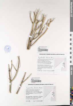
LE 01229272
Euphorbia larica Boiss. det. Byalt, Vyacheslav Vyacheslavovich
Collectors: Byalt, Vyacheslav Vyacheslavovich Field collecting number: 797. Collection date: 30.03.2017. Administrative regions: AE - United Arab Emirates. Place of collection: Фуджейра, окрестности г. Манама, скалы-останцы (среди песков).Groups of specimens: Образцы общего сектора; Соглашение Минобрнауки №075-15-2021-1056; Бялт В.В.: Флора ФуджейрыOriginal label text: United Arab Emirates. Emirate of Fujaira, environs of Al Manama, 25°20,020’ N, 56° 11,847’ E: on destroyed rocky outcrops. – ОАЭ, Фуджейра, окрестности г. Манама, 25°20,020’ N, 56° 11,847’ E: на скалах останцах (среди песков), 30 III 2017, V.V. Byalt
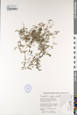
LE 01229270
Euphorbia serpens Kunth det. Geltman, Dmitri Victorovich
Collectors: Byalt, Vyacheslav Vyacheslavovich; Korshunov, Mikhail Vladimirovich Field collecting number: 1680. Collection date: 23.11.2019. Administrative regions: AE - United Arab Emirates. Place of collection: Фуджейра, горы Хаджар. Старая дорога Масафи-Дибба, окрестности пос. Аль Хала, сорное возле АЗС ADNOC на газонах.Groups of specimens: Образцы общего сектора; Соглашение Минобрнауки №075-15-2021-1056; Бялт В.В.: Флора ФуджейрыOriginal label text: United Arab Emirates. Mts. Hajar. Old road Masafi-Dibba, vil. Al Khala, 25°28'58.62"N 56°11'31.12"E, ca. 190 m alt.: weeds near the gas station ADNOC on grass plots.– ОАЭ, Фуджейра, горы Хаджар. Старая дорога Масафи-Дибба, окр. Аль Хала, 25 ° 28'58.62 "N 56 ° 11'31.12" E, ок. 190 м н.ур.м.: сорняк возле АЗС ADNOC на газоннах, 23 XI 2019, fl., fr., V.V. Byalt, M.V. Korshunov 1680
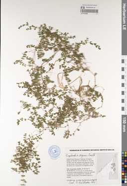
LE 01229269
Euphorbia serpens Kunth det. Geltman, Dmitri Victorovich at 2021
Collectors: Byalt, Vyacheslav Vyacheslavovich; Korshunov, Mikhail Vladimirovich Field collecting number: 1404. Collection date: 21.11.2019. Administrative regions: AE - United Arab Emirates. Place of collection: Фуджейра, г. Дибба, аллея около стадиона и прилегающие улочки на границе с Оманом: сорное на газоне.Groups of specimens: Образцы общего сектора; Соглашение Минобрнауки №075-15-2021-1056; Бялт В.В.: Флора ФуджейрыOriginal label text: United Arab Emirates. Emirate of Fujaira, Dibba, 25°36'59.8"N 56°18'40.02"E, 12 m alt., an alley near the stadium and adjacent streets on the border with Oman: cultivated / weed on the lawn; in a vacant lot; in irrigation circles. – ОАЭ, Фуджейра, Дибба, 25°36'59.8"N 56°18'40.02"E, 12 м н. ур. м., аллея около стадиона и прилегающие улочки на границе с Оманом: сорное на газоне, 21 XI 2019, fl., fr., V.V. Byalt, M.V. Korshunov 1404
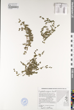
LE 01229268
Euphorbia serpens Kunth det. Geltman, Dmitri Victorovich
Collectors: Byalt, Vyacheslav Vyacheslavovich; Korshunov, Mikhail Vladimirovich Field collecting number: 1718. Collection date: 23.11.2019. Administrative regions: AE - United Arab Emirates. Place of collection: Фуджейра, горы Хаджар. Старая дорога Масафи-Дибба: нижние и боковые склоны вади; маленький финиковый сад в вади.Groups of specimens: Образцы общего сектора; Соглашение Минобрнауки №075-15-2021-1056; Бялт В.В.: Флора ФуджейрыOriginal label text: United Arab Emirates. Mts. Hajar. Old road Masafi-Dibba, 25°22'10"N 56°11'08"E, ca. 490 m alt.: weed in small date garden in wadi. – ОАЭ, Фуджейра, горы Хаджар. Старая дорога Масафи-Дибба, 25 ° 22'10 "N 56 ° 11'08" E, ок. 490 м над уровнем моря: нижние и боковые склоны Вади; маленький финиковый сад в вади, 23 XI 2019,fl., fr., V.V. Byalt, M.V. Korshunov 1718
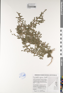
LE 01229267
Euphorbia serpens Kunth det. Geltman, Dmitri Victorovich
Collectors: Byalt, Vyacheslav Vyacheslavovich; Korshunov, Mikhail Vladimirovich Field collecting number: 1431. Collection date: 22.11.2019. Administrative regions: AE - United Arab Emirates. Place of collection: Фуджейра, пос. Авала, сорное во дворе форта Ахвала.Groups of specimens: Образцы общего сектора; Соглашение Минобрнауки №075-15-2021-1056; Бялт В.В.: Флора ФуджейрыOriginal label text: United Arab Emirates. Emirate of Fujaira, vil. Ahwala, 24°54'31.11"N 56°18'11.596"E, ca. 80 m alt.: weed in the yard of Ahwala Fort. – ОАЭ, Фуджейра, пос. Авала, 24 ° 54'31,11 "N 56 ° 18'11,596" E, ок. 80 м н.ур.м.: сорняк во дворе форта Ахвала, 22 XI 2019,fl., fr., V.V. Byalt, M.V. Korshunov 1431
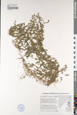
LE 01229266
Euphorbia serpens Kunth det. Byalt, Vyacheslav Vyacheslavovich
Collectors: Byalt, Vyacheslav Vyacheslavovich; Korshunov, Mikhail Vladimirovich Field collecting number: 1480. Collection date: 23.11.2019. Administrative regions: AE - United Arab Emirates. Place of collection: Фуджейра, горы Хаджар. Старая дорога Масафи-Дибба, сады в северо-западной окрестности пос. Аль Хала, сорное в частном саду Абдулы.Groups of specimens: Образцы общего сектора; Соглашение Минобрнауки №075-15-2021-1056; Бялт В.В.: Флора ФуджейрыOriginal label text: United Arab Emirates. Mts. Hajar. Old road Masafi-Dibba, gardens in NW environs of vil. Al Khala, 25°29'02.84"N 56°11'22"E, ca. 180 m alt.: weed in the private garden of Abdulah.– ОАЭ, Фуджейра, горы Хаджар. Старая дорога Масафи-Дибба, сады в сев.-зап. окр. пос. Аль Хала, 25 ° 29'02.84 "N 56 ° 11'22" E, ок. 180 м н. ур. м.: сорняк в частном саду Абдулы, 23 XI 2019,fl.,fr., V.V. Byalt, M.V. Korshunov 1480
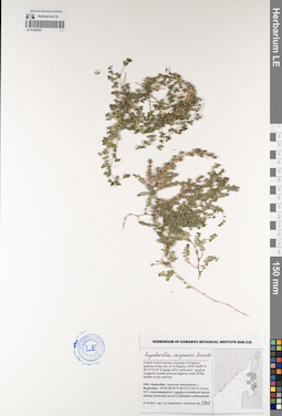
LE 01229265
Euphorbia serpens Kunth det. Byalt, Vyacheslav Vyacheslavovich
Collectors: Byalt, Vyacheslav Vyacheslavovich; Korshunov, Mikhail Vladimirovich Field collecting number: 1815. Collection date: 27.11.2019. Administrative regions: AE - United Arab Emirates. Place of collection: Фуджейра, морская набережная г. Фуджейра [точка 347]: сорное в поливных кругах между полосами шоссе в середине набережной.Groups of specimens: Образцы общего сектора; Соглашение Минобрнауки №075-15-2021-1056; Бялт В.В.: Флора ФуджейрыOriginal label text: United Arab Emirates. Emirate of Fujaira, seafront of the city of Al Fujeira, 25°07'18.09"N 56°21'22.92"E [point 347]: cultivated / weed in irrigated rounds between highway lanes at the middle of the seefront. – ОАЭ, Фуджейра, морская набережная г. Фуджейра, 25°06'38.35"N 56°21'27.04"E [точка 347]: сорняк в поливных кругах между полосами шоссе в середине набережной, 27 XI 2019,fl.,fr., V.V. Byalt & M.V. Korshunov 1815
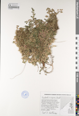
LE 01229264
Euphorbia serpens Kunth det. Geltman, Dmitri Victorovich
Collectors: Byalt, Vyacheslav Vyacheslavovich; Korshunov, Mikhail Vladimirovich Field collecting number: 1712. Collection date: 25.11.2019. Administrative regions: AE - United Arab Emirates. Place of collection: Фуджейра, пос. Кидфа [point 343]: обочины дорог и вдоль стен и заборов в переулках, сорное под финиковыми пальмами.Groups of specimens: Образцы общего сектора; Соглашение Минобрнауки №075-15-2021-1056; Бялт В.В.: Флора ФуджейрыOriginal label text: United Arab Emirates. Emirate of Fujaira, village Qidfa, 25°17'40.91"N 56°21'28.51"E [point 343]: roadsides and along walls and fences in backstreets,under date palms, in irrigated pits. – ОАЭ, Фуджейра, пос. Кидфа, 25°17'40.91"N 56°21'28.51"E [point 343]: обочины дорог и вдоль стен и заборов в переулках, сорное под финиковыми пальмами, 25 XI 2019, fl., fr., V.V. Byalt & M.V. Korshunov 1712
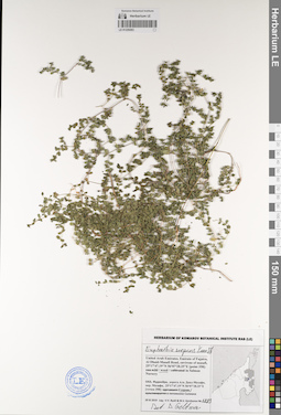
LE 01229263
Euphorbia serpens Kunth det. Geltman, Dmitri Victorovich
Collectors: Byalt, Vyacheslav Vyacheslavovich; Korshunov, Mikhail Vladimirovich Field collecting number: 1883. Collection date: 29.11.2019. Administrative regions: AE - United Arab Emirates. Place of collection: Фуджейра, дорога Аль Даид-Мазафи, окрестности пос. Мазафи [точка 358]: сорное в питомнике Салмана.Groups of specimens: Образцы общего сектора; Соглашение Минобрнауки №075-15-2021-1056; Бялт В.В.: Флора ФуджейрыOriginal label text: United Arab Emirates. Emirate of Fujaira, Al Dhaid-Masafi Road, environs of Masafi, 25°17'47.19"N 56°07'28.25"E [point 358]: weed in Salman Nursery. – ОАЭ, Фуджейра, дорога Аль Даид-Мазафи, окр. Мазафи, 25°17'47.19"N 56°07'28.25"E [точка 358]: сорняк в питомнике Салмана, 29 XI 2019, fl., fr., V.V. Byalt & M.V. Korshunov 1883
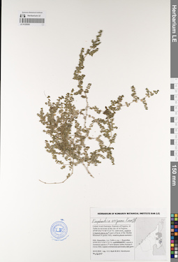
LE 01229262
Euphorbia serpens Kunth det. Byalt, Vyacheslav Vyacheslavovich
Collectors: Byalt, Vyacheslav Vyacheslavovich; Korshunov, Mikhail Vladimirovich Field collecting number: 1600. Collection date: 24.11.2019. Administrative regions: AE - United Arab Emirates. Place of collection: Фуджейра, Аль Тайба в окрестности г. Фуджейра [точка 342]: культивируется в поливных кругах в северной части фермы шейха Хамада II.Groups of specimens: Образцы общего сектора; Соглашение Минобрнауки №075-15-2021-1056; Бялт В.В.: Флора ФуджейрыOriginal label text: United Arab Emirates. Emirate of Fujaira, Al Taiba in environs of the city of Al Fujeira, 25°09'29.6"N 56°17'31"E [point 342]: weed in irrigated places in N part of farm of the Sheikh Khamad II. – ОАЭ, Фуджейра, Аль Тайба в окр. г. Фуджейра, 25°09'29.6"N 56°17'31"E, [точка 342]: культивируется в поливных кругах в N части фермы шейха Хамада II, 24 XI 2019 V.V. Byalt & M.V. Korshunov
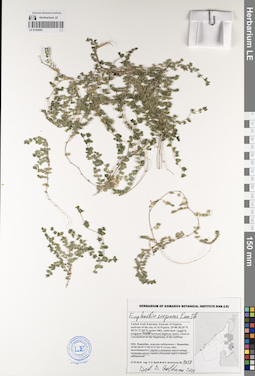
LE 01229261
Euphorbia serpens Kunth det. Geltman, Dmitri Victorovich at 2021
Collectors: Byalt, Vyacheslav Vyacheslavovich; Korshunov, Mikhail Vladimirovich Field collecting number: 1758. Collection date: 27.11.2019. Administrative regions: AE - United Arab Emirates. Place of collection: Фуджейра, морская набережная г. Фуджейра [точка 346]: сорное в поливных кругах между полосами шоссе.Groups of specimens: Образцы общего сектора; Соглашение Минобрнауки №075-15-2021-1056; Бялт В.В.: Флора ФуджейрыOriginal label text: United Arab Emirates. Emirate of Fujaira, seafront of the city of Al Fujeira, 25°06'38.35"N 56°21'27.04"E [point 346]: weed in irrigated circles between highway lanes. – ОАЭ, Фуджейра, морская набережная г. Фуджейра, 25°06'38.35"N 56°21'27.04"E [точка 346]: сорняк в поливных кругах между полосами шоссе, 27 XI 2019, fl., fr., V.V. Byalt & M.V. Korshunov 1758
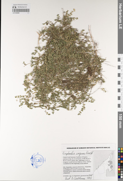
LE 01229260
Euphorbia serpens Kunth det. Geltman, Dmitri Victorovich at 2021
Collectors: Byalt, Vyacheslav Vyacheslavovich; Korshunov, Mikhail Vladimirovich Field collecting number: 1765. Collection date: 27.11.2019. Administrative regions: AE - United Arab Emirates. Place of collection: Фуджейра, морская набережная г. Фуджейра [точка 346]: сорное в поливных кругах между полосами шоссе.Groups of specimens: Образцы общего сектора; Соглашение Минобрнауки №075-15-2021-1056; Бялт В.В.: Флора ФуджейрыOriginal label text: United Arab Emirates. Emirate of Fujaira, seafront of the city of Al Fujeira, 25°06'38.35"N 56°21'27.04"E [point 346]: weed in irrigated circles between highway lanes. – ОАЭ, Фуджейра, морская набережная г. Фуджейра, 25°06'38.35"N 56°21'27.04"E [точка 346]: сорняк в поливных кругах между полосами шоссе, 27 XI 2019, fl., fr., V.V. Byalt & M.V. Korshunov 1765
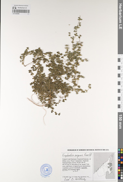
LE 01229259
Euphorbia serpens Kunth det. Geltman, Dmitri Victorovich
Collectors: Byalt, Vyacheslav Vyacheslavovich; Korshunov, Mikhail Vladimirovich Field collecting number: s.n. Collection date: 17.03.2020. Administrative regions: AE - United Arab Emirates. Place of collection: Fujairah Emirate, Al Dibba town, Wam Community. Fujairah National Dairy Farm [point 714]: weed in vegetable garden.Groups of specimens: Образцы общего сектора; Соглашение Минобрнауки №075-15-2021-1056; Бялт В.В.: Флора ФуджейрыOriginal label text: United Arab Emirates, Fujairah Emirate, Al Dibba town, Wam Community. Fujairah National Dairy Farm.
25°36'2.49"N, 56°14'2.64"E, elevation 25 m. [point 714]: weed in vegetable garden, 17 III 2020, fl., fr., V.V. Byalt, M.V. Korshunov [742?]
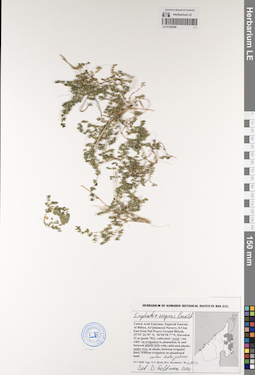
LE 01229258
Euphorbia serpens Kunth det. Geltman, Dmitri Victorovich at 2021
Collectors: Byalt, Vyacheslav Vyacheslavovich; Korshunov, Mikhail Vladimirovich Field collecting number: 2933. Collection date: 15.05.2020. Administrative regions: AE - United Arab Emirates. Place of collection: Fujairah Emirate, Al Bidiya, Al Qalamoon Nursery, 0.3 km East from Eid Prayer Ground Bidyah [point 781]: weed on irrigation under date palms.Groups of specimens: Образцы общего сектора; Соглашение Минобрнауки №075-15-2021-1056; Бялт В.В.: Флора ФуджейрыOriginal label text: United Arab Emirates. Fujairah Emirate, Al Bidiya, Al Qalamoon Nursery, 0.3 km East from Eid Prayer Ground Bidyah, 25°25' 24.70" N, 56°20'18.77"E, Elevation 22 m [point 781]: weed on irrigation under date palms, 15 V 2020, V.V. Byalt, M.V. Korshunov 2933
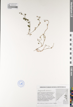
LE 01229257
Campanula erinus L. det. Byalt, Vyacheslav Vyacheslavovich
Collectors: Byalt, Vyacheslav Vyacheslavovich; Korshunov, Mikhail Vladimirovich Field collecting number: 2943a. Collection date: 19.05.2020. Administrative regions: AE - United Arab Emirates. Place of collection: Fujairah Emirate, Al Bidiya, Al Qalamoon Nursery, 0.3 km East from Eid Prayer Ground Bidyah [point 781]: weed in and between plastic pots with cultivated plants.Groups of specimens: Образцы общего сектора; Соглашение Минобрнауки №075-15-2021-1056; Бялт В.В.: Флора ФуджейрыOriginal label text: United Arab Emirates. Fujairah Emirate, Al Bidiya, Al Qalamoon Nursery, 0.3 km East from Eid Prayer Ground Bidyah, 25°25' 24.70" N, 56°20'18.77"E, Elevation 22 m [point 781]: weed in and between plastic pots with cultivated plants, 19 V 2020, fr., V.V. Byalt, M.V. Korshunov 2943a