View
Add
Copy
Edit
Delete
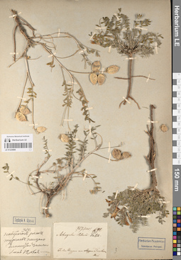
LE 01224890
Groups of specimens: Образцы сектора Средней Азии; Соглашение Минобрнауки №075-15-2021-1056Record creation: 2023-03-10, Mariya Sheludyakova, PhotoScan D2. Part 1.Citation: Specimen LE 01224890 // Virtual herbarium of Komarov Botanical Institute RAS — http://re.herbariumle.ru/01224890
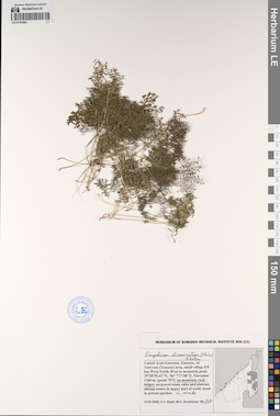
LE 01193562
Onychium divaricatum (Poir.) Alston det. Byalt, Vyacheslav Vyacheslavovich
Collectors: Byalt, Vyacheslav Vyacheslavovich; Korshunov, Mikhail Vladimirovich Field collecting number: 348. Collection date: 13.03.2020. Administrative regions: AE - United Arab Emirates. Place of collection: Fujairah Emirate, Al Tawyeen (Taween) area, small village 0.8 km West-North-West to mountain peak, on mountain rock ledges, in cracks.Groups of specimens: Образцы общего сектора; Соглашение Минобрнауки №075-15-2021-1056; Бялт В.В.: Флора ФуджейрыOriginal label text: United Arab Emirates, Fujairah Emirate, Al Tawyeen (Taween) area, small village 0.8 km West-North-West to mountain peak. 25°38'59.41"N, 56° 7'17.88"E, elevation 1360 m. [point 707]: on mountain rock ledges, in cracks, 13 III 2020, veg., V.V. Byalt, M.V. Korshunov 348
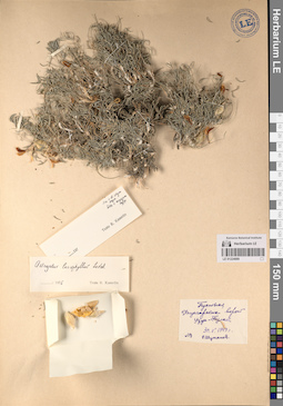
LE 01224889
Groups of specimens: Образцы сектора Средней Азии; Соглашение Минобрнауки №075-15-2021-1056Record creation: 2023-03-10, Mariya Sheludyakova, PhotoScan D2. Part 1.Citation: Specimen LE 01224889 // Virtual herbarium of Komarov Botanical Institute RAS — http://re.herbariumle.ru/01224889
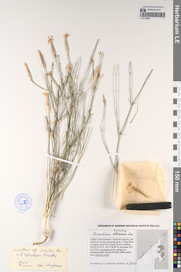
LE 01193561
Dianthus crinitus Sm. det. Byalt, Vyacheslav Vyacheslavovich
Collectors: Byalt, Vyacheslav Vyacheslavovich; Korshunov, Mikhail Vladimirovich Field collecting number: 3070. Collection date: 20.05.2020. Administrative regions: AE - United Arab Emirates. Place of collection: Fujairah Emirate, the cell tower on the mountain peak, 3.5 km West to Ghub, 8 km West-South-West to Dibba, [719a]: on bottom of dry spring and between rocks.Groups of specimens: Образцы общего сектора; Соглашение Минобрнауки №075-15-2021-1056; Бялт В.В.: Флора ФуджейрыOriginal label text: United Arab Emirates, Fujairah Emirate, the cell tower on the mountain peak, 3.5 km West to Ghub, 8 km West-South-West to Dibba, 25°34'14.16"N, 56° 9'58.28"E, elevation 765 m [719a]: on bottom of dry spring and between rocks, 20 V 2020, fl., fr., V.V. Byalt 3070
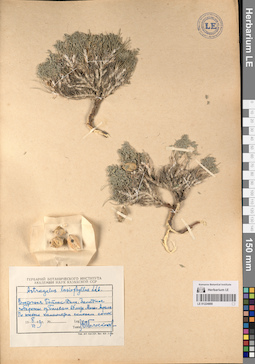
LE 01224888
Groups of specimens: Образцы сектора Средней Азии; Соглашение Минобрнауки №075-15-2021-1056Record creation: 2023-03-10, Mariya Sheludyakova, PhotoScan D2. Part 1.Citation: Specimen LE 01224888 // Virtual herbarium of Komarov Botanical Institute RAS — http://re.herbariumle.ru/01224888
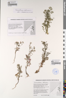
LE 01193560
Coriandrum sativum L. det. Byalt, Vyacheslav Vyacheslavovich at 11.2022
Collectors: Byalt, Vyacheslav Vyacheslavovich; Korshunov, Mikhail Vladimirovich Field collecting number: 1002b. Collection date: 23.03.2020. Administrative regions: AE - United Arab Emirates. Place of collection: Fujairah Emirate, Masafi friday market, E88 Al Dhaid – Masafi road, 4 km to Masafi, in plant market and plant nursery.Groups of specimens: Образцы общего сектора; Соглашение Минобрнауки №075-15-2021-1056; Бялт В.В.: Флора ФуджейрыOriginal label text: United Arab Emirates, Fujairah Emirate, Masafi friday market, E88 Al Dhaid – Masafi road, 4 km to Masafi. 25°17'47.12"N, 56° 7'26.88"E, elevation 380 m: in plant market and plant nursery, 23 III 2020, fl., V.V. Byalt, M.V. Korshunov 1002b
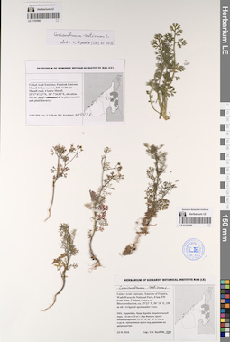
LE 01193559
Coriandrum sativum L. det. Byalt, Vyacheslav Vyacheslavovich
Collectors: Byalt, Vyacheslav Vyacheslavovich Field collecting number: 138. Collection date: 23.03.2017. Administrative regions: AE - United Arab Emirates. Place of collection: Фуджейра, Вади Вурайа Национальный парк, в 8 км северо-западнее г. Хор Факкан, Центр Биорепродукции, орошаемые круги во дворе центра.Groups of specimens: Образцы общего сектора; Соглашение Минобрнауки №075-15-2021-1056; Бялт В.В.: Флора ФуджейрыOriginal label text: United Arab Emirates. Emirate of Fujaira, Wadi Wurayah National Park, 8 km NW from Khor Fakkan, Centre of Bioreproduction, ca. 25°23’ N, 56° 18’ E, 150 m alt.: irrigated spots in the yard.– ОАЭ, Фуджейра, Вади Вурайа Национальный парк, в 8 км к СЗ от г. Хор Факкан, Центр Биорепродукции, 25°23’ N, 56° 18’ E, 150 м н.ур.м.: орошаемые круги во дворе центра, 23 III 2017, V.V. Byalt 138
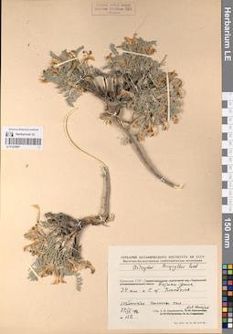
LE 01224887
Groups of specimens: Образцы сектора Средней Азии; Соглашение Минобрнауки №075-15-2021-1056Record creation: 2023-03-10, Mariya Sheludyakova, PhotoScan D2. Part 1.Citation: Specimen LE 01224887 // Virtual herbarium of Komarov Botanical Institute RAS — http://re.herbariumle.ru/01224887
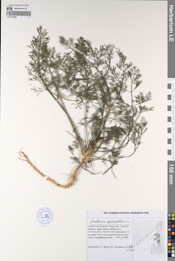
LE 01193558
Anethum graveolens L. det. Byalt, Vyacheslav Vyacheslavovich
Collectors: Byalt, Vyacheslav Vyacheslavovich; Korshunov, Mikhail Vladimirovich Field collecting number: 1420. Collection date: 30.03.2020. Administrative regions: AE - United Arab Emirates. Place of collection: village Bithna, Bithna Fort, weed in garden close the fort wall.Groups of specimens: Образцы общего сектора; Соглашение Минобрнауки №075-15-2021-1056; Бялт В.В.: Флора ФуджейрыOriginal label text: United Arab Emirates, Fujairah Emirate, village Bithna, Bithna Fort. 25°11'13.38"N, 56°14'17.34"E, elevation 172 m. [point 725]: weed in garden close the fort wall, near pat=, 30 III 2020, veg., V.V. Byalt, M.V. Korshunov 1420
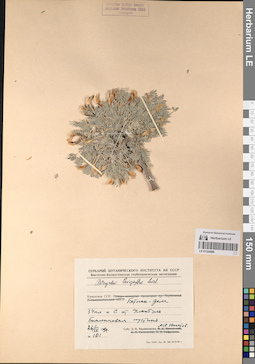
LE 01224886
Groups of specimens: Образцы сектора Средней Азии; Соглашение Минобрнауки №075-15-2021-1056Record creation: 2023-03-10, Mariya Sheludyakova, PhotoScan D2. Part 1.Citation: Specimen LE 01224886 // Virtual herbarium of Komarov Botanical Institute RAS — http://re.herbariumle.ru/01224886
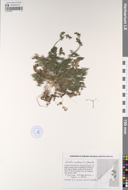
LE 01193557
Torilis nodosa (L.) Gaertn. det. Byalt, Vyacheslav Vyacheslavovich
Collectors: Byalt, Vyacheslav Vyacheslavovich; Korshunov, Mikhail Vladimirovich Field collecting number: 1188. Collection date: 26.03.2020. Administrative regions: AE - United Arab Emirates. Place of collection: Al Bidya, gardens near roundabout, 0.8 km on E99 road to Dibba (north), on roadsides, near garden walls, в проходе между домом и садом, на песке.Groups of specimens: Образцы общего сектора; Соглашение Минобрнауки №075-15-2021-1056; Бялт В.В.: Флора ФуджейрыOriginal label text: United Arab Emirates, Fujairah Emirate, Al Bidya, gardens near roundabout, 0.8 km on E99 road to Dibba (north), 25°26'44.46"N, 56°21'27.16"E, elevation 4 m: on roadsides, near garden walls, в проходе между домом и садом, на песке, 26 III 2020, fl., fr., V.V. Byalt, M.V. Korshunov 1188
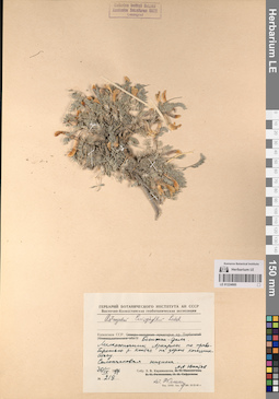
LE 01224885
Groups of specimens: Образцы сектора Средней Азии; Соглашение Минобрнауки №075-15-2021-1056Record creation: 2023-03-10, Mariya Sheludyakova, PhotoScan D2. Part 1.Citation: Specimen LE 01224885 // Virtual herbarium of Komarov Botanical Institute RAS — http://re.herbariumle.ru/01224885
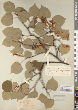
LE 01057437
Groups of specimens: Образцы сектора Сибири и Дальнего Востока России; Типовые образцы сектора Сибири и Дальнего Востока России; Соглашение Минобрнауки №075-15-2021-1056Record creation: 2023-03-09, Marina Yarichina, PhotoScan D2.Citation: Specimen LE 01057437 // Virtual herbarium of Komarov Botanical Institute RAS — http://re.herbariumle.ru/01057437

LE 01193556
Pycnocycla cespitosa Boiss. et Hausskn. ex Boiss. det. Byalt, Vyacheslav Vyacheslavovich
Additional identifications: Pycnocycla nodiflora Decne. ex Boiss. det. Byalt, Vyacheslav Vyacheslavovich Collectors: Byalt, Vyacheslav Vyacheslavovich; Korshunov, Mikhail Vladimirovich Field collecting number: 1095. Collection date: 24.03.2020. Administrative regions: AE - United Arab Emirates. Place of collection: Fujairah emirate, 0.6 km East-North-East to cell tower on the mountain peak, 3.5 km West to Ghub, 8 km West-South-West to Dibba, in stone wadi, under rock.Groups of specimens: Образцы общего сектора; Соглашение Минобрнауки №075-15-2021-1056; Бялт В.В.: Флора ФуджейрыOriginal label text: United Arab Emirates, Fujairah emirate, 0.6 km East-North-East to cell tower on the mountain peak, 3.5 km West to Ghub, 8 km West-South-West to Dibba. 25°34'34.49"N, 56°10'6.31"E, elevation 730 m. [point 720]: in stone wadi, under rock, 24 III 2020, fl. pink, V.V. Byalt, M.V. Korshunov 1095
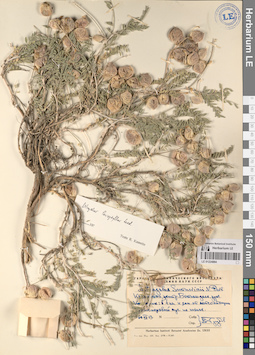
LE 01224884
Astragalus sumneviczii Pavl. det. Knjazev, Mikhail Sergeyevich at 2024
Groups of specimens: Образцы сектора Средней Азии; Соглашение Минобрнауки №075-15-2021-1056Record creation: 2023-03-10, Mariya Sheludyakova, PhotoScan D2. Part 1.Citation: Specimen LE 01224884 // Virtual herbarium of Komarov Botanical Institute RAS — http://re.herbariumle.ru/01224884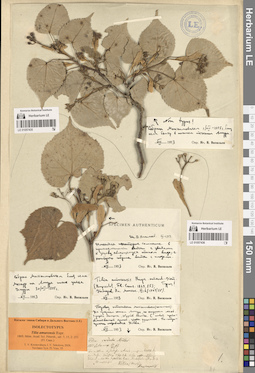
LE 01057435
Groups of specimens: Образцы сектора Сибири и Дальнего Востока России; Типовые образцы сектора Сибири и Дальнего Востока России; Соглашение Минобрнауки №075-15-2021-1056Record creation: 2023-03-09, Marina Yarichina, PhotoScan D2.Citation: Specimen LE 01057435 // Virtual herbarium of Komarov Botanical Institute RAS — http://re.herbariumle.ru/01057435
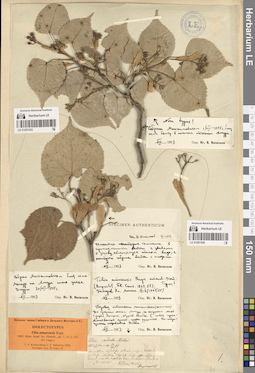
LE 01057436
Isolectotype of Tilia amurensis Rupr. det. Krestovskaya, Tatiana Valerievna, Sokolova, Irina Viktorovna at 2024
Additional identifications: Tilia cordata Mill. det. Maximowicz, Carl Johann Groups of specimens: Образцы сектора Сибири и Дальнего Востока России; Типовые образцы сектора Сибири и Дальнего Востока России; Соглашение Минобрнауки №075-15-2021-1056Record creation: 2023-03-09, Marina Yarichina, PhotoScan D2.Citation: Specimen LE 01057436 // Virtual herbarium of Komarov Botanical Institute RAS — http://re.herbariumle.ru/01057436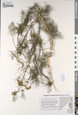
LE 01193555
Anethum graveolens L. det. Byalt, Vyacheslav Vyacheslavovich
Collectors: Byalt, Vyacheslav Vyacheslavovich; Korshunov, Mikhail Vladimirovich Field collecting number: 1145. Collection date: 26.03.2020. Administrative regions: AE - United Arab Emirates. Place of collection: Fujariah Emirate, Rul Dadhna, drainage channel, buildings, on roadsides, по краю декоративных посадок у магазина, под кустарником.Groups of specimens: Образцы общего сектора; Соглашение Минобрнауки №075-15-2021-1056; Бялт В.В.: Флора ФуджейрыOriginal label text: United Arab Emirates, Fujariah Emirate, Rul Dadhna, drainage channel, buildings. 25°31'9.23"N, 56°21'19.67"E, elevation 13 m.: on roadsides, по краю декоративных посадок у магазина, под кустарником, 26 III 2020, fl., V.V. Byalt, M.V. Korshunov 1145
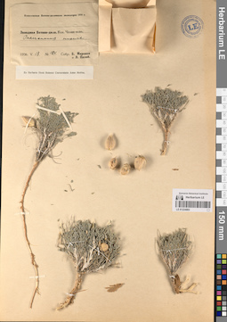
LE 01224883
Groups of specimens: Образцы сектора Средней Азии; Соглашение Минобрнауки №075-15-2021-1056Record creation: 2023-03-10, Mariya Sheludyakova, PhotoScan D2. Part 1.Citation: Specimen LE 01224883 // Virtual herbarium of Komarov Botanical Institute RAS — http://re.herbariumle.ru/01224883
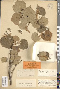
LE 01057434
Isolectotype of Tilia amurensis Rupr. det. Sokolova, Irina Viktorovna, Krestovskaya, Tatiana Valerievna at 2024
Additional identifications: Tilia cordata Mill. det. Maximowicz, Carl Johann Groups of specimens: Образцы сектора Сибири и Дальнего Востока России; Типовые образцы сектора Сибири и Дальнего Востока России; Соглашение Минобрнауки №075-15-2021-1056Record creation: 2023-03-09, Marina Yarichina, PhotoScan D2.Citation: Specimen LE 01057434 // Virtual herbarium of Komarov Botanical Institute RAS — http://re.herbariumle.ru/01057434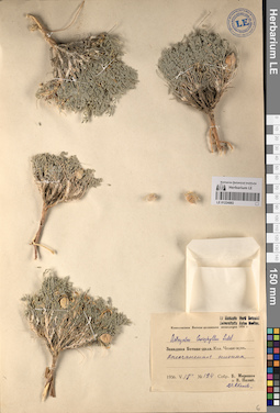
LE 01224882
Groups of specimens: Образцы сектора Средней Азии; Соглашение Минобрнауки №075-15-2021-1056Record creation: 2023-03-10, Mariya Sheludyakova, PhotoScan D2. Part 1.Citation: Specimen LE 01224882 // Virtual herbarium of Komarov Botanical Institute RAS — http://re.herbariumle.ru/01224882
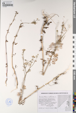
LE 01193554
Coriandrum sativum L. det. Byalt, Vyacheslav Vyacheslavovich
Collectors: Byalt, Vyacheslav Vyacheslavovich; Korshunov, Mikhail Vladimirovich Field collecting number: 966. Collection date: 22.03.2020. Administrative regions: AE - United Arab Emirates. Place of collection: Sharjah Emirate, Khor-Fakkan, shady garden between Khor-Fakkan Port and Al Rabi Tower, weed on grassplot.Groups of specimens: Образцы общего сектора; Соглашение Минобрнауки №075-15-2021-1056; Бялт В.В.: Флора ФуджейрыOriginal label text: United Arab Emirates, Sharjah Emirate, Khor-Fakkan, shady garden between Khor-Fakkan Port and Al Rabi Tower. 25°20'40.63"N, 56°21'34.91"E, elevation 6 m: weed on grassplot, 22 III 2020, fl., V.V. Byalt, M.V. Korshunov 966
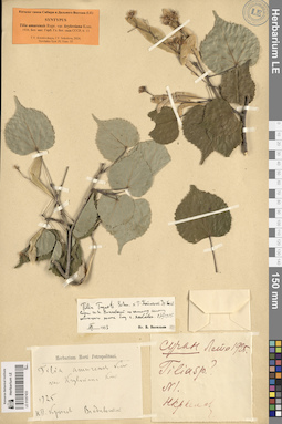
LE 01057433
Syntype of Tilia amurensis var. kryloviana Kom. det. Krestovskaya, Tatiana Valerievna, Sokolova, Irina Viktorovna at 2024
Additional identifications: Tilia amurensis var. kryloviana Kom. det. Komarov, Vladimir Leontjevich Groups of specimens: Образцы сектора Сибири и Дальнего Востока России; Типовые образцы сектора Сибири и Дальнего Востока России; Соглашение Минобрнауки №075-15-2021-1056Record creation: 2023-03-09, Marina Yarichina, PhotoScan D2.Citation: Specimen LE 01057433 // Virtual herbarium of Komarov Botanical Institute RAS — http://re.herbariumle.ru/01057433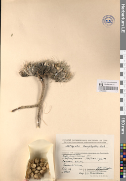
LE 01224881
Groups of specimens: Образцы сектора Средней Азии; Соглашение Минобрнауки №075-15-2021-1056Record creation: 2023-03-10, Mariya Sheludyakova, PhotoScan D2. Part 1.Citation: Specimen LE 01224881 // Virtual herbarium of Komarov Botanical Institute RAS — http://re.herbariumle.ru/01224881
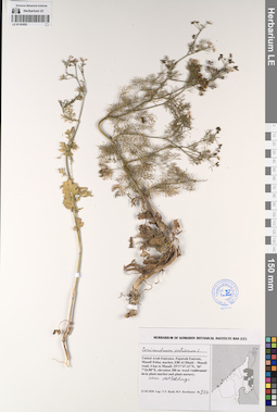
LE 01193553
Coriandrum sativum L. det. Byalt, Vyacheslav Vyacheslavovich
Collectors: Byalt, Vyacheslav Vyacheslavovich; Korshunov, Mikhail Vladimirovich Field collecting number: 977. Collection date: 23.03.2020. Administrative regions: AE - United Arab Emirates. Place of collection: Fujairah Emirate, Masafi friday market, E88 Al Dhaid – Masafi road, 4 km to Masafi, weed in plant market and plant nursery, near outbuildings.Groups of specimens: Образцы общего сектора; Соглашение Минобрнауки №075-15-2021-1056; Бялт В.В.: Флора ФуджейрыOriginal label text: United Arab Emirates, Fujairah Emirate, Masafi friday market, E88 Al Dhaid – Masafi road, 4 km to Masafi. 25°17'47.12"N, 56° 7'26.88"E, elevation 380 m: weed in plant market and plant nursery, near outbuildings, 23 III 2020, fl., V.V. Byalt, M.V. Korshunov 977
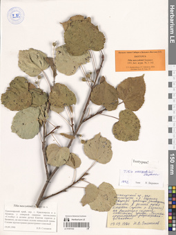
LE 01057432
Isotype of Tilia nasczokinii Stepanov det. Stepanov Nikolay V. at 1992
Groups of specimens: Образцы сектора Сибири и Дальнего Востока России; Типовые образцы сектора Сибири и Дальнего Востока России; Соглашение Минобрнауки №075-15-2021-1056Record creation: 2023-03-09, Marina Yarichina, PhotoScan D2.Citation: Specimen LE 01057432 // Virtual herbarium of Komarov Botanical Institute RAS — http://re.herbariumle.ru/01057432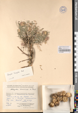
LE 01224880
Groups of specimens: Образцы сектора Средней Азии; Соглашение Минобрнауки №075-15-2021-1056Record creation: 2023-03-10, Mariya Sheludyakova, PhotoScan D2. Part 1.Citation: Specimen LE 01224880 // Virtual herbarium of Komarov Botanical Institute RAS — http://re.herbariumle.ru/01224880
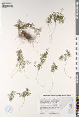
LE 01193552
Onychium divaricatum (Poir.) Alston det. Byalt, Vyacheslav Vyacheslavovich
Collectors: Byalt, Vyacheslav Vyacheslavovich Field collecting number: 514. Collection date: 31.03.2017. Administrative regions: AE - United Arab Emirates. Place of collection: Шаржа, глубокое ущелье на границе с Фуджейрой, на скалах.Groups of specimens: Образцы общего сектора; Соглашение Минобрнауки №075-15-2021-1056; Бялт В.В.: Флора ФуджейрыOriginal label text: United Arab Emirates. Emirate of Sharjah, 25°22, 997’ N, 56° 01, 211’ E, 470 m alt., gorge on borders with Fujaira: on rocks.– ОАЭ, Шаржа, 25°22, 997’ N, 56° 01, 211’ E, 470 м выс., глубокое ущелье на границе с Фуджейрой: на скалах, 31 III 2017, V.V. Byalt 514
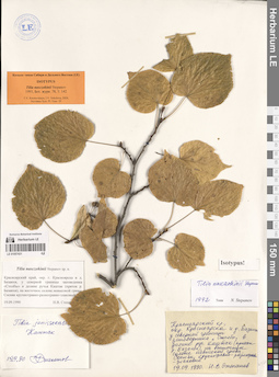
LE 01057431
Isotype of Tilia nasczokinii Stepanov det. Stepanov Nikolay V. at 1992
Groups of specimens: Образцы сектора Сибири и Дальнего Востока России; Типовые образцы сектора Сибири и Дальнего Востока России; Соглашение Минобрнауки №075-15-2021-1056Record creation: 2023-03-09, Marina Yarichina, PhotoScan D2.Citation: Specimen LE 01057431 // Virtual herbarium of Komarov Botanical Institute RAS — http://re.herbariumle.ru/01057431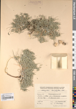
LE 01224879
Groups of specimens: Образцы сектора Средней Азии; Соглашение Минобрнауки №075-15-2021-1056Record creation: 2023-03-10, Mariya Sheludyakova, PhotoScan D2. Part 1.Citation: Specimen LE 01224879 // Virtual herbarium of Komarov Botanical Institute RAS — http://re.herbariumle.ru/01224879
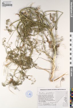
LE 01193551
Anethum graveolens L. det. Byalt, Vyacheslav Vyacheslavovich
Collectors: Byalt, Vyacheslav Vyacheslavovich; Korshunov, Mikhail Vladimirovich Field collecting number: 2227. Collection date: 17.04.2020. Administrative regions: AE - United Arab Emirates. Place of collection: Fujairah Emirate, Rul Dhadna, villas and accommodations north from Mina road, on corner with E99 Rugaylat road [point 755]: in dranaige, сорное место за магазином в переулке.Groups of specimens: Образцы общего сектора; Соглашение Минобрнауки №075-15-2021-1056; Бялт В.В.: Флора ФуджейрыOriginal label text: United Arab Emirates. Fujairah Emirate, Rul Dhadna, villas and accommodations north from Mina road, on corner with E99 Rugaylat road. 25°31'16.29"N, 56°21'19.69"E, Elevation 12 m [point 755]: in dranaige, сорное место за магазином в переулке, 17 IV 2020, fl., fr., V.V. Byalt, M.V. Korshunov 2227
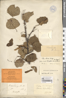
LE 01057430
Additional identifications: Lectotype of Tilia sibirica Bayer det. Krestovskaya, Tatiana Valerievna at 2024; Lectotype of Tilia semicuneata Rupr. det. Krestovskaya, Tatiana Valerievna at 2024 Groups of specimens: Образцы сектора Сибири и Дальнего Востока России; Типовые образцы сектора Сибири и Дальнего Востока России; Соглашение Минобрнауки №075-15-2021-1056Record creation: 2023-03-09, Marina Yarichina, PhotoScan D2.Citation: Specimen LE 01057430 // Virtual herbarium of Komarov Botanical Institute RAS — http://re.herbariumle.ru/01057430
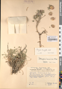
LE 01224878
Astragalus sumneviczii Pavl. det. Knjazev, Mikhail Sergeyevich at 2024
Groups of specimens: Образцы сектора Средней Азии; Соглашение Минобрнауки №075-15-2021-1056Record creation: 2023-03-10, Mariya Sheludyakova, PhotoScan D2. Part 1.Citation: Specimen LE 01224878 // Virtual herbarium of Komarov Botanical Institute RAS — http://re.herbariumle.ru/01224878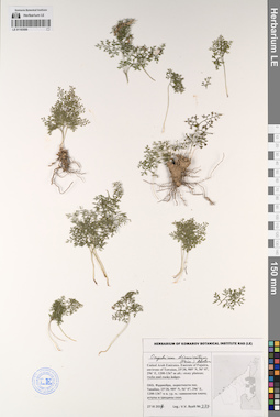
LE 01193550
Onychium divaricatum (Poir.) Alston det. Byalt, Vyacheslav Vyacheslavovich
Collectors: Byalt, Vyacheslav Vyacheslavovich Field collecting number: 377. Collection date: 27.03.2017. Administrative regions: AE - United Arab Emirates. Place of collection: Фуджейра, окрестности пос. Тавайан, уступы и трещины скал.Groups of specimens: Образцы общего сектора; Соглашение Минобрнауки №075-15-2021-1056; Бялт В.В.: Флора ФуджейрыOriginal label text: United Arab Emirates. Emirate of Fujaira, environs of Tawaian, 25°38, 989’ N, 56° 07, 296’ E, 1200-1367 m alt.: below of stony plateau, on rocks and rocky ledges. – ОАЭ, Фуджейра, окрестности пос. Тавайан, 25°38, 989’ N, 56° 07, 296’ E, 1200-1367 м н. ур. м.: уступы и трещины скал, 27 III 2017, V.V. Byalt 377
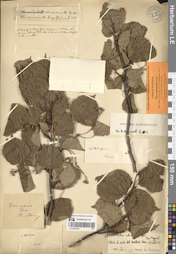
LE 01057429
Isolectotype of Tilia semicuneata Rupr. det. Krestovskaya, Tatiana Valerievna, Sokolova, Irina Viktorovna at 2024
Groups of specimens: Образцы сектора Сибири и Дальнего Востока России; Типовые образцы сектора Сибири и Дальнего Востока России; Соглашение Минобрнауки №075-15-2021-1056Record creation: 2023-03-09, Marina Yarichina, PhotoScan D2.Citation: Specimen LE 01057429 // Virtual herbarium of Komarov Botanical Institute RAS — http://re.herbariumle.ru/01057429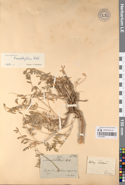
LE 01224877
Groups of specimens: Образцы сектора Средней Азии; Соглашение Минобрнауки №075-15-2021-1056Record creation: 2023-03-10, Mariya Sheludyakova, PhotoScan D2. Part 1.Citation: Specimen LE 01224877 // Virtual herbarium of Komarov Botanical Institute RAS — http://re.herbariumle.ru/01224877
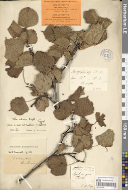
LE 01057428
Additional identifications: Isolectotype of Tilia sibirica Bayer det. Krestovskaya, Tatiana Valerievna, Sokolova, Irina Viktorovna at 2024; Isolectotype of Tilia semicuneata Rupr. det. Krestovskaya, Tatiana Valerievna, Sokolova, Irina Viktorovna at 2024 Groups of specimens: Образцы сектора Сибири и Дальнего Востока России; Типовые образцы сектора Сибири и Дальнего Востока России; Соглашение Минобрнауки №075-15-2021-1056Record creation: 2023-03-09, Marina Yarichina, PhotoScan D2.Citation: Specimen LE 01057428 // Virtual herbarium of Komarov Botanical Institute RAS — http://re.herbariumle.ru/01057428
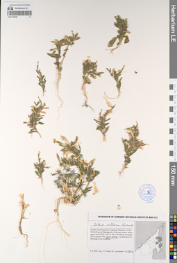
LE 01193549
Silene villosa Forssk. det. Byalt, Vyacheslav Vyacheslavovich
Collectors: Byalt, Vyacheslav Vyacheslavovich; Korshunov, Mikhail Vladimirovich Field collecting number: 1730. Collection date: 03.04.2020. Administrative regions: AE - United Arab Emirates. Place of collection: Fujairah Emirate, 2.2 km North from Al Manama by E18 road, water valves near road. [point 731], water spillage.Groups of specimens: Образцы общего сектора; Соглашение Минобрнауки №075-15-2021-1056; Бялт В.В.: Флора ФуджейрыOriginal label text: United Arab Emirates, Fujairah Emirate, 2.2 km North from Al Manama by E18 road , water valves near road. 25°21'1.38"N, 56° 1'24.38"E, elevation 222 m. [point 731]: Water spillage, 3 IV 2020, V.V. Byalt, M.V. Korshunov 1730
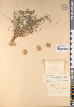
LE 01224876
Astragalus sumneviczii Pavl. det. Knjazev, Mikhail Sergeyevich at 2024
Groups of specimens: Образцы сектора Средней Азии; Соглашение Минобрнауки №075-15-2021-1056Record creation: 2023-03-10, Mariya Sheludyakova, PhotoScan D2. Part 1.Citation: Specimen LE 01224876 // Virtual herbarium of Komarov Botanical Institute RAS — http://re.herbariumle.ru/01224876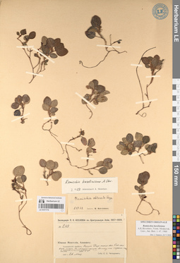
LE 01071774
Groups of specimens: Образцы сектора Центральной и Восточной Азии; Типовые образцы сектора Центральной и Восточной Азии; Соглашение Минобрнауки №075-15-2021-1056Record creation: 2023-03-10, Artyom Leostrin, PhotoScan D2. Part 2.Citation: Specimen LE 01071774 // Virtual herbarium of Komarov Botanical Institute RAS — http://re.herbariumle.ru/01071774
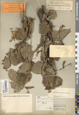
LE 01057427
Isolectotype of Tilia semicuneata Rupr. det. Krestovskaya, Tatiana Valerievna, Sokolova, Irina Viktorovna at 2024
Groups of specimens: Образцы сектора Сибири и Дальнего Востока России; Типовые образцы сектора Сибири и Дальнего Востока России; Соглашение Минобрнауки №075-15-2021-1056Record creation: 2023-03-09, Marina Yarichina, PhotoScan D2.Citation: Specimen LE 01057427 // Virtual herbarium of Komarov Botanical Institute RAS — http://re.herbariumle.ru/01057427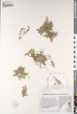
LE 01193548
Herniaria cinerea DC. det. Lazkov, Georgiy Anatol'evich; Laz'kov at 2023
Collectors: Byalt, Vyacheslav Vyacheslavovich; Korshunov, Mikhail Vladimirovich Field collecting number: 1013. Collection date: 24.03.2020. Administrative regions: AE - United Arab Emirates. Place of collection: Fujairah emirate, 0.6 km East-North-East to cell tower on the mountain peak, 3.5 km West to Ghub, 8 km West-South-West to Dibba [point 720]: on abandoned baghara (winter season dryland farm).Groups of specimens: Образцы общего сектора; Соглашение Минобрнауки №075-15-2021-1056; Бялт В.В.: Флора ФуджейрыOriginal label text: United Arab Emirates, Fujairah Emirate, 0.6 km East-North-East to cell tower on the mountain peak, 3.5 km West to Ghub, 8 km West-South-West to Dibba. 25°34'34.49"N, 56°10'6.31"E, elevation 730 m. [point 720]: on abandoned baghara (winter season dryland farm), 24 III 2020, V.V. Byalt, M.V. Korshunov 1013
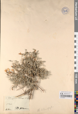
LE 01224875
Groups of specimens: Образцы сектора Средней Азии; Соглашение Минобрнауки №075-15-2021-1056Record creation: 2023-03-10, Mariya Sheludyakova, PhotoScan D2. Part 1.Citation: Specimen LE 01224875 // Virtual herbarium of Komarov Botanical Institute RAS — http://re.herbariumle.ru/01224875
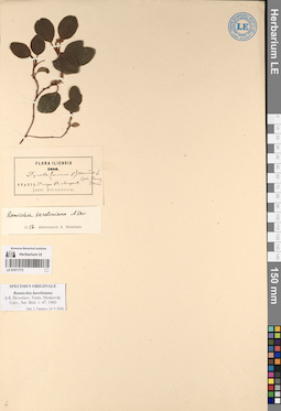
LE 01071773
Groups of specimens: Образцы сектора Центральной и Восточной Азии; Типовые образцы сектора Центральной и Восточной Азии; Соглашение Минобрнауки №075-15-2021-1056Record creation: 2023-03-10, Artyom Leostrin, PhotoScan D2. Part 2.Citation: Specimen LE 01071773 // Virtual herbarium of Komarov Botanical Institute RAS — http://re.herbariumle.ru/01071773
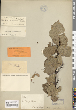
LE 01057426
Isolectotype of Tilia semicuneata Rupr. det. Krestovskaya, Tatiana Valerievna, Sokolova, Irina Viktorovna at 2024
Groups of specimens: Образцы сектора Сибири и Дальнего Востока России; Типовые образцы сектора Сибири и Дальнего Востока России; Соглашение Минобрнауки №075-15-2021-1056Record creation: 2023-03-09, Marina Yarichina, PhotoScan D2.Citation: Specimen LE 01057426 // Virtual herbarium of Komarov Botanical Institute RAS — http://re.herbariumle.ru/01057426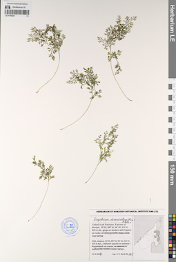
LE 01193547
Onychium divaricatum (Poir.) Alston det. Byalt, Vyacheslav Vyacheslavovich
Collectors: Byalt, Vyacheslav Vyacheslavovich Field collecting number: 505. Collection date: 31.03.2017. Administrative regions: AE - United Arab Emirates. Place of collection: эмират Шаржа, глубокое ущелье на границе с Фуджейрой, на скалах.Groups of specimens: Образцы общего сектора; Соглашение Минобрнауки №075-15-2021-1056; Бялт В.В.: Флора ФуджейрыOriginal label text: United Arab Emirates. Emirate of Sharjah, 25°22, 997’ N, 56° 01, 211’ E, 470 m alt., gorge on borders with Fujaira: on rocks.– ОАЭ, Шаржа, 25°22, 997’ N, 56° 01, 211’ E, 470 м выс., глубокое ущелье на границе с Фуджейрой: на скалах, 31 III 2017, V.V. Byalt 505
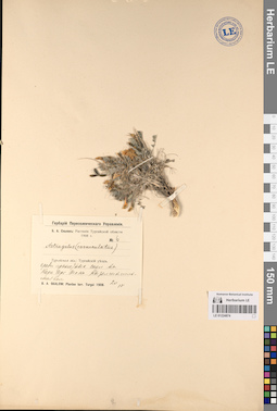
LE 01224874
Groups of specimens: Образцы сектора Средней Азии; Соглашение Минобрнауки №075-15-2021-1056Record creation: 2023-03-10, Mariya Sheludyakova, PhotoScan D2. Part 1.Citation: Specimen LE 01224874 // Virtual herbarium of Komarov Botanical Institute RAS — http://re.herbariumle.ru/01224874
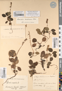
LE 01071771
Groups of specimens: Образцы сектора Центральной и Восточной Азии; Типовые образцы сектора Центральной и Восточной Азии; Соглашение Минобрнауки №075-15-2021-1056Record creation: 2023-03-10, Artyom Leostrin, PhotoScan D2. Part 2.Citation: Specimen LE 01071771 // Virtual herbarium of Komarov Botanical Institute RAS — http://re.herbariumle.ru/01071771
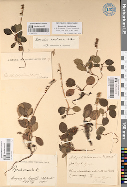
LE 01071770
Groups of specimens: Образцы сектора Центральной и Восточной Азии; Типовые образцы сектора Центральной и Восточной Азии; Соглашение Минобрнауки №075-15-2021-1056Record creation: 2023-03-10, Artyom Leostrin, PhotoScan D2. Part 2.Citation: Specimen LE 01071770 // Virtual herbarium of Komarov Botanical Institute RAS — http://re.herbariumle.ru/01071770
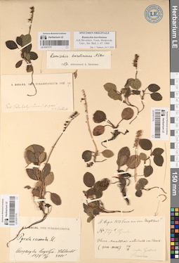
LE 01071772
Groups of specimens: Образцы сектора Центральной и Восточной Азии; Типовые образцы сектора Центральной и Восточной Азии; Соглашение Минобрнауки №075-15-2021-1056Record creation: 2023-03-10, Artyom Leostrin, PhotoScan D2. Part 2.Citation: Specimen LE 01071772 // Virtual herbarium of Komarov Botanical Institute RAS — http://re.herbariumle.ru/01071772